Introduction
The generation of today must be highly responsive to attain a safe, long-lasting response to the looming waste management problem (Adamson 2012). It is normally a matter of responsibility to exercise appropriate waste disposal because some waste is highly detrimental (Adamson 2012). One of the most debatable waste products is the radioactive waste that often attracts international, public, legal and ethical disputes that pertain to human safety and environmental depletion. Although it is normally significant to dispose of radioactive waste appropriately not to affect the humans and the environment, people often wonder as to where and how to dispose of this deadly radioactive waste (Adamson 2012). Geologists often recommend companies to carry out preliminary assessments of the sites proposed for the disposal of harmful waste products such as radioactive wastes. Due to such concerns, this paper provides a preliminary site assessment of Sellafield, as a geological disposal facility used for shallow disposal of lower activity radioactive wastes.
Site Description: Geographical Location Sellafield
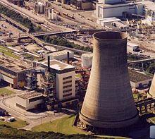
Sellafield is one of the main UK’s geological disposal sites or the respiratory sites recommended for disposing of high and lower reactive radioactive wastes, especially those emanating from the nuclear power plants (Cruickshank 2013). Sellafield is a geological disposal site recommended by the Nuclear Decommissioning Authority (NDA), which is the authorized UK organization that plans and organizes geological disposal facilities (Cruickshank 2013). In terms of its geographical location, Sellafield is a nuclear disposal facility located within the Seascale Village, which is near the coast of the Irish Sea in the Cambria District of the United Kingdom. Located near the Northwest Coast of England around the Irish Sea region and served by the Sellafield Railway Station, this facility attracts numerous ethical, legal, and public discourses concerning the safety of the marine creatures and the human beings (Cruickshank 2013). The Sellafield geological disposal facility lies just 1 kilometer in distance from the Irish Sea, and just about 25 kilometers from the Sellafield Village.
In terms of natural sceneries, Sellafield lies on the western border of a national park known as the Lake District National Park, and on the feet of the Rivers Calder and Ehen (Adamson 2012). The licensed boundary occupied by the Sellafield Geological facility is approximately 276 hectors of land. The major local towns that surround the Sellafield geological facility are the Workington town, the Whitehaven town, and the Barrow town (Sellafield Ltd. 2012). These towns are approximately 14 kilometers on the north side of Sellafield, 25 kilometers to the north, and 38 kilometers southwest in that order. Small paths around the Sellafield facility are for the Sellafield traffic routes, which have about four principal pedestrian gates. The area immediate to Sellafield is mainly under farming activities and some residential purposes (Sellafield Ltd. 2012). Although there are no industries within 5 kilometers from Sellafield, there is a chemical processing plant at Workington, approximately 36 kilometers from Sellafield.
Topographical Description of Sellafield
The Sellafield disposal facility is hazardous to human life and the marine creatures due to its unfavorable topography. Topographically, the Sellafield nuclear disposal facility is unsafe because it lies within a region that has a steep topography estimated at +9.00 to +48.00-meters Above Ordnance Datum (AOD) (Sellafield Ltd. 2012, p. 12). Sellafield lies 54 degrees north and 3 degrees west in terms of altitude. It encompasses rapid surface runoffs that are within the water catchment areas where the major rivers find their water sources. Coupled with a highly sensitive hydrology that encompasses two, rapidly flowing rivers that react to ferociously to the rainfall, the Sellafield respiratory site is harmful because the percolation of harmful nuclear substances is almost unavoidable (Adamson 2012). Although this topographic range makes Sellafield not to be susceptible to any credible risk associated with the flooding events, which scientifically happens to areas with a 7.39m AOD in an estimated period of over 10,000 years, Sellafield is still a risky site for geological disposal.
Geological and topographical surveys carried out to determine the suitability and reliability of the Sellafield region for geological disposal activities reveal that the area still puts the people and marine creatures at risk (Haszeldine & Smythe 2000). Some sites are at great risk of wave and tidal actions that may result from the unprecedented tsunami catastrophes. Although the site has an adequate defense against internal flood events that may occur from the Rivers Calder and Ehen, extreme rainfall events can cause significant environmental and human hazards (Haszeldine & Smythe 2000). The Rivers Calder and Ehen also pose significant risks because River Calder, which can cause about one flooding event in 10,000 years as earlier estimated, also presents risks of fluvial floods around the East region of the riverbank, where the Calder Hall Site originates (Blowers 2014). Topographical scientists postulated that high dynamic events of powerful rains that may occur unexpectedly might cause mechanical damages to the machines that protect the disposal facility.
Hydrological Description of Sellafield
Sellafield geological disposal site lies within the high water catchment areas of the Rivers Ehen and River Calder, which are the giant rivers around the Sellafield region. The water catchment areas of River Calder and its tributary River Newmill Beck have an approximated total area of about 55.5 square kilometers (Sellafield Ltd. 2008). On the other hand, the catchment area of River Ehen has about 156.6 square kilometers in the covered area (Sellafield 2008). Sellafield area lies at the end of the catchment area of River Calder. In terms of river directional flow, the River Calder flows via the south-southwest direction of the Sellafield disposal facility (Sellafield Ltd. 2008). The River Calder has a historic construction of 1974 that the engineers designed to convey a rate of water flow of about 310 cubic meters per second. This construction was to counter flood events that may occur within the estimated 10,000 years as earlier assessed by the geologists and topologists.
Another surface catchment area in the Sellafield region is the River Ehen catchment area that has the Ehen River that flows through the southeastern direction of the Sellafield disposal facility. According to Kew, Richmond, & Surrey (2008), it is in this southeast site border where the River Ehen meets the River Calder before the two rivers flow across the beach area into the Irish Sea. Concerning the Newmill Beck River, this tributary river flows within the areas of the southeastern edge of the disposal site, where there is a culvert made to divert the flow of the river into a licensed landfill and beneath the Sellafield Coastal Railway line (Sellafield Ltd. 2012). After crossing the railway, the Newmill Beck River fills two little ponds beyond the watermark levels before discharging into River Calder. Such hydrological descriptions indicate that the Sellafield respiratory site is a highly detrimental disposal facility. Even geologists have established that the two giant rivers react rapidly to the constant rainfall events.
Description of the Historic and the Current Land Use
The Sellafield region of the Cambria District has been a region historically known to associate with agricultural activities and commercial activities associated with the production of agricultural chemicals and sprays (Merritt 2013). Before the beginning of 1941, Sellafield was a region where the Royal Ordinance Factory operated. Most of the factories that operated within this region were chemical producing companies that delved into producing plant chemicals and chemical storage facilities used for the production of trinitrotoluene (TNT) (Merritt 2013). The production of TNT ended during the end of the Second World War when the UK government cleared the area in 1946. Towards the 1947s, the British government acquired Sellafield and developed it to a site used for the location of the first atomic reactors of the British army (Merritt 2013). An atomic reactor plant was also set here. In the 1950s, the British government developed the first atomic power generation sites around the Calder Hall, where site expansion has commenced intermittently.
From the 1960s onwards, the Calder Hall geological construction has been serving the purpose of reprocessing used nuclear fuel and has been a site that the government uses for the temporary storage of liquid and solid nuclear waste reprocessed before verification, before encapsulation, and before storage (Cruickshank 2013). Such historical description reveals that Sellafield has been experiencing a significant number of spills and leaks that have significantly contaminated the seawaters, the shallow ground, and the agricultural soils (Price 2011). Although the hazardous spills and leaks have remained confined within the Separation Area that the government had designed, several climatic and geographic activities have occurred in the history of Sellafield (Cruickshank 2013). However, the Separation Area can never prove safe because Sellafield is a high catchment area comprised of two giant rivers, and river and rainy waters have been ferrying contaminated leaks and spills that have recently been contaminating the superficial groundwater and the core sandstone layer.
Geology of the Sellafield Geological Disposal Site
The Sellafield area has been unsuitable for the continued development and expansion of the Sellafield respiratory facility because of its longstanding controversies on issues that pertain to its geology (Cruickshank 2013). The first question that the geological scientists wanted to answer was whether there existed an appropriate hard rock of about 200 to 1,000 meters around Sellafield, which could withstand about 6 to 11 Albert Halls of highly reactive nuclear wastes. An initial scientific report concerning the geological suitability of the Sellafield region had indicated that Sellafield was, and would never be a suitable site for developing geological disposal facilities because of its unsuitable geology. The report stated, “it is in the national interest that we squander no more time in basing our entire national nuclear waste strategy around seeking a geological disposal solution in entirely unsuitable geology” (Blowers 2014, p. 550). Perhaps a deeper assessment of the superficial and solid geology of the Sellafield region can best explain such proclamations.
Superficial Geology
In geological sciences, superficial deposits are the latest geological deposits on the earth that have never lasted for more than 2.6 million years (Adamson 2012). These superficial deposits are in form of large unconsolidated sediments of recent soil deposits such as the floodplain soils, the gravel soils, the beach sand, the glacial deposits, or the moraine (Pepper, Webster & Reville 2003). Geological surveys carried out to determine the suitability of the Sellafield area as a geological respiratory zone for highly radioactive nuclear waste reveals that the superficial layers of Sellafield are unsafe for the development of the disposal facility. The upper surface of the Sellafield area is full of alluvial soil and the sand goes as deeper as 45 meters below the land surface. The quaternary deposits around the Sellafield area make up most of the superficial soil and geological material closest to the ground surface (Pepper et al. 2003). When analyzed through the domain geological model, most of the quaternary soil deposits are around the Sellafield geological disposal facility.
Quaternary deposits are generally weak soil sediments and when exposed to flooding events, tidal or glacial actions, they easily move, break, or disintegrate from each other (Pepper et al. 2003). An evaluation of the quaternary deposits in England shows that these soils constantly change and may become withered or vegetated depending on the physical or climatic actions that are affecting the region. Given the sloppy topography and the constantly running rivers that have unpredictable overflows during the rainy seasons, the superficial layer of the Sellafield may continue posing significant risks to the survival of the human beings and the marine creatures (Kenny 2003). At a depth of 45-55 meters above the land surface, the large area under the quaternary deposits poses the risks of contaminated percolations and seepages of the highly radioactive nuclear wastes. Because the scientific estimates and presumptions on earthquake intensities and floods can hardly prove significant, the superficial layer of Sellafield is still a predisposing factor to soil and groundwater contamination.
Solid Geology
Geological Scientists believe that a geological disposal facility meant for low or high radioactive waste must remain constructed in a stable geological setting, which is normally around an unwavering rock. According to Davies (2012), the suitability of the Sellafield hard rock for the disposal of lower activity radioactive wastes and higher activity radioactive wastes is still a doubting issue given the characteristic of its rock. Sellafield has bedrock that comprises of Triassic Calder type of rock material and Ormskirk sandstone, which are part of the Sherwood Sandstone Group (SSG) (Davies 2012). The Sherwood Group of Sandstones comprises of the carboniferous sandstone, the Permian aquifer, and the Ordovician aquifers, which may remain irrelevant in the case of Sellafield. The current SGG rock stratum beneath the land surface of Sellafield has a thickness range of about 650 meters and 1150 meters from the land surface (Kenny 2003). This thickness represents an overage of about 800m in the overall thickness of the SGG aquifer.
The positioning of the rock is strategic in inclination and direction as it immerses in the direction of the southwest on an average inclination angle of 25 degrees. The above rock characteristics of Sellafield meet the standards of developing a geological disposal facility for highly radioactive nuclear waste as the range matches the geological rock standards that provide a range from 200 meters to 1,000 meters (Barker & Tellam 2006). The size of rock thickness that ranges from 650 meters to 1150 meters is suitable in accommodating a Rock Characterization Facility (RCF) that would 6 to 11 Albert Halls. These large Albert Halls are capable of accommodating high-level activity wastes from the radioactive disposals and other intermediate-level wastes from the radioactive disposals (Barker & Tellam 2006). The only persistent dilemma that still lingers around the development of the RCF is the arrangement of the superficial stratum and the bedrock stratum. In Sellafield, the superficial layer and the bedrock seem to share a common water table.
Hydrogeology
Hydrogeology is normally the geological assessment of the distribution of underground water, the flow of underground water, and the quality of the underground water (Barker & Tellam 2006). The hydrogeological assessment of Sellafield reveals that the Sellafield region lies on a ground that is full of alluvial sand, glacial soil and moraine soil material in its superficial layer and a Triassic Sandstone aquifer makes-up its underlying bedrock. According to Oughton and Hansson (2013), the Triassic Sandstone has bedding planes that dip towards southwest into the Coast of Sellafield. In Sellafield, the underground water in which the science of hydrogeology focuses on most comes from the groundwater from River Ehen and River Calder. The two rivers have catchment areas that have regularly suffered the consequences of uncontrolled contamination from the agricultural chemicals and the nucleic impurities (Davies 2012). The groundwater from the nearby catchment areas contaminates the bedrock because the superficial stratum and the bedrock share a common water table.
Geo-hazards
The Sellafield site may not be a suitable site for a safe geological disposal site due to the geological hazards that may pose threats to the safety of the highly radioactive nuclear waste (Oughton & Hansson 2013). Flooding due to high rainfall events is an indispensable issue around Sellafield because the River Ehen and River Calder are highly sensitive to rainfall events due to the nature of the unstable superficial layer. The site is not conducive for disposing of lower activity radioactive nuclear wastes because the superficial layer consists of weak superficial deposits made up of the alluvial soils, large coarse-grained sands, beach sands, gravel deposits, glacial soil material, and some patchy clay soils (Barker & Tellam 2003). Even though the Sellafield disposal facility has reinforcements from powerful ground barriers that often provides adequate protection against the intermittent floods and erosions, extreme rains from unexpected conditions may pose threats to the safety of the lower activity radioactive wastes in Sellafield.
It is upsetting to notice that scientists are only providing unrealistic climatic forecasts and estimations concerning the structures of the Sellafield disposal facility, without considering the unpredictability of the geological events (National Audit Office 2012). The prevailing scientific investigations on the suitability of Sellafield show that tsunamis, seismic actions, and other earthquake events are potential geological hazards to the survival of the Sellafield disposal facility. The historical assessment concerning the earthquake events in Britain shows that the British seismic activities vary considerably within the different geographical regions of Great Britain (National Audit Office 2012). Although seismologists regularly provide scientific projections about the occurrence of seismic activities, most of their predictions often fall of the expectations and sometimes never apply in the geological world. Although Sellafield may not express severe seismic actions, even the little earthquake of 0.25g in magnitude is capable of altering the structures, systems, and components of the Sellafield geological facility (National Audit Office 2012). Volcanic activities such as glaciations, high and low sea temperatures may alter with the site.
Assessment of the Above Geological Concerns
The British government acted upon the community and expert recommendations to set up the geological disposal facility around Sellafield, but this respiratory site is still the most unsafe area for geological disposals (Barker & Tellam 2003). When one evaluates the topographical conditions, the hydro-geological characteristics, and the geological conditions of the superficial stratum of the Sellafield region, it is eminent that the region is unfit for the development of a facility that would cater for the lower activity radioactive wastes. Compared to the situation of the Triassic Sandstone bedrock that at least offers the required rigidity for the construction of geological facilities that would support the storage of higher activity radioactive wastes, the superficial layer is geologically unstable (Blowers 2014). The steep nature of the topography of Sellafield, the rivers that are highly sensitive to rainfall events, and the nature of the weak superficial deposits make Sellafield unsuitable for the development of a facility that would store low-level radioactive nuclear waste.
Conclusions and Recommendations
As long as Sellafield contains features, that predispose its geological facility to catastrophic events and climatic problems that make it vulnerable to contamination of the groundwater and soil, it is automatically unfit for the construction of a geological disposal facility. Low-sensitive radioactive reactors and the remnants of industrial chemicals can react to even the lowest climatic and geological actions as long as they provide a significant chance for their chemical and physical reactions. However much geologists, seismologists, and hydro-geologists might want to provide unproven facts about the stability of the Sellafield disposal facility and in term provide unrealistic targets about the climate and the geological events, Sellafield is a highly risky respiratory site. Most of their scientific predictions and presumptions are beyond the known scientific frontier and require constant evaluations to make them meaningful. Here are some of the recommendations that may help to make Sellafield a safe disposal site:
- The site is unsuitable for shallow disposal of lower activity radioactive wastes and thus, reconstructing and rehabilitating the current lower disposal site is necessary.
- The British government should focus on improving the state of the Rock Characterization Facility (RCF) to improve the storage of higher activity wastes.
References
Adamson, P 2012, Moving Forward Together: Process for Selecting a Site for Canada’s Deep Geological Repository for Used Nuclear Fuel, Web.
Barker, R & Tellam, J 2006, Fluid Flow and Solute Movement in Sandstones: The Onshore UK Permo-Triassic Red Bed Sequence, Geological Society of London, London.
Blowers, A 2014, ‘A geological disposal facility for nuclear waste if not Sellafield, then where?’, Town & Country Planning, vol. 1, no. 1, pp. 545-553.
Cruickshank, J 2013, The Sellafield Contaminated Land and Groundwater Management Project: Characterisation of a Complex Nuclear Facility, Web.
Davies, H 2012, Sellafield Stories: Life in Britain’s First Nuclear Plant, Little, Brown Book Group Publishers, London.
Haszeldine, R, & Smythe, D 2000, ‘Radioactive Waste Disposal at Sellafield, UK: Site selection, geological, and engineering problems’, Quarterly Journal of Engineering and Geology, vol. 29, no. 2, pp. 1-493.
Kenny, C 2003, Fearing Sellafield: what it is and why the Irish want it shut, Gill & Macmillan Publishers, London.
Kew, R, Richmond, A, & Surrey, C 2008, Managing Radioactive Waste Safely A Framework for Implementing Geological Disposal, Web.
Merritt, J 2013, Characterisation of Quaternary deposits in West Cumbria using the concept of domains: A case study, Web.
National Audit Office 2012, Managing Risk Reduction at Sellafield: Nuclear Decommissioning Authority, The Stationery Office, London.
Oughton, D & Hansson, S 2013, Social and Ethical Aspects of Radiation Risk Management, Newnes Publishers, London.
Pepper, D, Webster, F & Reville, G 2003, Environmentalism: Critical Concepts, Volume 4, Taylor & Francis, London.
Price, T 2013, Key to Britain’s energy future: The Strategy for Sellafield, Web.
Sellafield Ltd. 2008, Groundwater Monitoring Annual Report 2008, Web.
Sellafield Ltd. 2012, Final Report to ONR on the application of the ENSREG Stress Tests to the Sellafield Site, Web.