Introduction
Marine Environmental High risk Areas (MEHRAs) was first used by Lord Donaldson in His Report titled Safe Ships, Clean Seas (1994). He defined these areas as locations with high environmental sensitivity and prone to high pollution due to heavy shipping activities. There are other natural activities characterizing these areas. In his report which he estimated the number of such areas to be less than 10% of the entire UK’s coast. He found out that 32 areas designated by the UK government after submitting the report were actually about 9% of the UK waters (Donaldson, 1994. P.219).
The objective of isolating the identified zones was to have them marked with clear indications and modern information gadgets which are visible by ship operators so that they can take precautions to avoid polluting the zones further or not to release any waste on those zones at all at specified times. Ship operators were put on notice by the action the UK government to on the report due to the revelations that such shores were already predisposed to looming problems caused by pollution leading high environmental risks (Great Britain, p.739). The risks whose magnitude is tackled in this discussion involved those that are exuberated by increased human activities in areas such as the Holy Island where Tourism is a leading activity and many visitors are not much careful with disposing of their refuse in the sea.
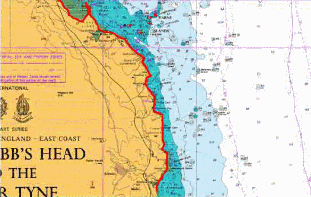
Some of the areas identified by the UK government and designated for MEHRs include Brass Rock, Berry head, Berwick, Dungeness, Fethaland- Mainland Shetland, Flamborough Head, Gallan Head-Isle of Lewis, Harwich & Felixtowe, Hastings, Holy Island, Pembrokeshire Islands, Plymouth, Portland and Tees Holy Island (Maritime and Coastguard Agency, 2007,p. 15).
Due to a number of challenges presently facing island biogeography, this paper makes use of Holy Island to provide an assessment of the MEHRAs and then it ends with provision of cost benefit analysis for the enhanced status of the island because of the measures put in place to preserve its status and keep its surrounding waters clean. From the times of industrial revolution in Europe, marine pollution has been going on despite efforts to keep the sea waters clean especially in deep shores.
According to the Department of the Environment Transport and the Regions (1999, p.30), it is up to recently when the International marine organization introduced laws can be enforced by all countries near coastlines after they agree to ratify them. It is in Europe where most of the marine activities are concentrated because of strategic location of industries near the shores. Besides, there are many harbors along UK’s shore line which activity round the clock. The operation of these shipping companies together with other human activities featuring recreation along the shore is a major contributor to pollution and ecological disturbance or destruction on the shorelines (Roberts, 2007, p.251).
When in February 12, 2000 the government declared 32 MEHRAs according Donaldson’s report, it showed its appreciation to efforts of many environmental scientists whose evaluation on the rate of marine environmental degradation indicated soaring levels of human encroachment and disturbance of the silicate ecological balance in the sea and associated ecosystem. Holy Island is just one example of how such activities have taken course, though in a small extent in this location.
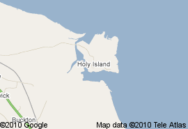
Holy island is located to the North East part of UK where it borders Scotland to the South. Its neighboring islands include Farne and other adjacent coastline islands (Whittaker, 2007.para 4-6).
Island description
Holy Island has underlying statutory designations which are based on its rich wildlife biodiversity in their natural habitat. The Island is a beautiful sanctuary for wildlife as well and provides a vantage point for bird watching and rock pooling. The island is separates from the main land by a narrow course way which can be crossed twice a day during low tide. Its beaches contain blue algae, sea urchins, and a number of aquatic species of fish only endemic to this site only.
The islands have varied landscape featuring the Lindisfarne’s wilderness in the gently sloping plains. It consists of geological grounds and fishing activities are common. There are limited economic activities which mainly concentrate in Hotel and Tourism industry. Currently, there are no routing measure in place since the movement to and from the island is controlled by monitoring of vessel scheduled and effected as per the reporting time. The government, through its agency, Marine Coastguard Agency ensures that all the vessels transporting cargo and people to and from the mainland follow strict booking time while at the same time issues information on the variations on the crossing time between the mainland and the Island. Holy Island is also associated with the history of Christianity. For that very purpose, it serves as an important camping and pilgrimage site to Christians who value it because of it religious functions. Its religious history dates back to the 15th century when Aidan, a monk from Iowa settled in it to build a temple. The ruins of the temple stand to this date (Losos and Ricklefs, 2010 para 2-6).
The Holy land is vulnerable due to many factors some of which were not included Donaldson’s analysis and criteria. As island rich history held passionately and personally to its in habitant are annual visitors, its loss is drawn closer by the same people who do not mange up to the Kingdoms expectations, the island’s resources. Many a times non person’s masquerading as tourist go to dig the cite for geological materials because they believe the myths associated with carrying home peaces from the site and this only adds to the site being vulnerable. Pollution from the adjacent waters when rerouting ships increases the risk of species loss in the site. Certain forms of pollution such as oil spills, waste release and turbulence during low tide caused by towing of ships may not be contained within one location due to the mobility of the waters. It therefore means that the effect of such activities equally impacts on the island’s shore where it alters the turbidity of the water and triggers waves which extensively washes the shore.
A major factor which makes the island more vulnerable is the fact that its existence is almost entirely dependent upon the rising and falling ocean tides. So that it is accessible only at low tide and out of. How can we rule that it is impossible for the island to be submerged sometime? The rate of erosion around its shore can be worsened by the now eminent climate change which leads to gradual in crease in water level. The small island has a limited area on which is fish can multiply. In the event that many people are involved in fishing both in the dip shore and on the onshore, then it leads to situation where overfishing may be an underlying factor likely to reduce the fish population here drastically resulting in destabilization of the entire ecosystem around the shore.
In essence, overfishing cause a shortage in the food chain which ultimately affects the food web leading to deterioration of certain species including those of certain types of fish. The species of birds which feed on fish is equally likely to migrate to another location where its will be guaranteed its prey. When the ruins of the church remnants are finally dug out, then the site loses its ubiquitous value. The numbers of persons who visit the site begin to get scarce and scarce by the year. This way the island risks its economic value without being noticed (Linden and Chircop. 2006. P. 42).
Illegal camping is another cause of vulnerability to the site. People who often anchor at the shore line end up camping for a day or two without formal arrangements pose great threats to the habitat of the wildlife which live in this zone. By clearing portions of the island for temporary shelter, they expose the natural habitat to other extreme environmental conditions which are detrimental to the inhabiting organisms. With increased transport as people move in with other new species of plants and animals like the wild weeds, this island stands the risk of invasion by alien species. Such species with high adaptation can easily colonize the island especially if they are from the tropical areas.
Assessment of existing protective measures
The existing protective measures were put in place with close consideration of Special Areas of Conservation (SACs), Special Protected Areas (APAs) and Sites of Special Scientific Interest (SSSIs). And the measures include obliging ships to notify ports in advance of their waste before leaving the port (Covello and Merkhofer. 1993, p.50). This directive was implemented by the UK in July 2003. It involved the use of modern equipment in monitoring vessels traffic services. Based on international Maritime organization and United Nations Convention on the law of the sea, this by far was significant to improvements of the way of handling marine pollution problems especially in times of crisis.
As stated by Farmer (1970, p.1), this idea ushered in the use of modern technology in the marine transport industry sector department of monitoring. This opened new opportunities for the freight companies to explore its resources with renewed hope for optimizing revenue and obtaining sustainable competitive advantage over their rivals. Beal limited which has its operations in Beal and Berwick is one such company which is now able to technically coordinate its activities through the monitoring strategy. It already has in at its disposal qualifies staff, assets, finance which can be used but now at a reduced cost while still maintaining the same revenue margin.
To accommodate the new changes, the company has the best option of integrating the proposed measure in its policies and principles aimed at increased financial output. The company’s subsequent progress after this report may largely depend on whether it is able to promote the safer and cleaner measures put forward by the government while it conducts promotions for its services or remain in the old freight and cargo suit of operations. The maximum tonnage of vessel carriage provides for container inspection which guarantees the company of its profitability in every dispatch of its cargo. The possibility of safer ship is equally provided by the same measure as it will allow for sustainability in its operations. Once the clients are informed of the changes, the objectives set by the company inline with the measures put in place can enable the customers to reschedule their expectations and anticipations toward the time stipulations by the freight intercommunication centre. This way the firm has the opportunity of satisfying its stakeholders while at the same time meeting the realistic demands of its stakeholders.
As part of its technical strategy, the firm can as well embark on constant restocking of its port warehouse to minimize delays from the reporting time schedule. The fact that the UK shorelines are now susceptible to risk from heavy ships should give Beal and other firms the opportunity to consider a unified tax bargains from the government. In order to give the shipping companies the lease to embark on new vessels acquisition as most of the existing carriers are old and present a great risk as presented in the reports. The improvement made it possible for the containers to carry Automatic Identifiable Systems. This facilitated safety and traffic monitoring of the cargo. It made it easier for the ship operators to be able to preplan the logistics of the cargo as it arrives at the harbor.
Since Lord Donaldson introduced the concept of MEHRAs, other measures which have been put in place to mitigate accident and operational damage to these sites including the Holy Island is the improvement of towing vessels, mandatory reporting systems for tankers carrying heavy grade of oil into the newly designated Western European and in particular, Sensitive Sea Area. This is a comprehensive approach to dealing with pollution since it normally presents a great challenge to the monitoring team when circumventing pollution caused by oil spills and blanket waste disposed haphazardly. In areas such as the Holy Island where endemic species are almost endangered, this measure is adequate enough in reinforcing the conservation measures are already in place (Joint Marine Programme, 2003, p.7).
The protection of vast biodiversity eminent in this island is considered improved yet again because the most sensitive spots have been identified and mitigation measures stepped up by increasing the number of staff demanded by Donaldson’s report to man the shoreline monitoring systems. The recommendations were adopted by the UK government and enacted when the government stepped up efforts to strengthen its Marine and Coastguard Agency (MCA). To that effect, the agency was assigned the programme of vessel traffic surveys around the UK coast to either validate the efficiency and adequacy of existing arrangements or suggest the need for extra measures.
In the course of this duty, the MCA came up with the proposal to reroute certain ships among other further recommendations. The cost of monitoring ships with Automatic Identifiable systems is relatively cheaper compared to other method s used previously such as direct sea patrol which was not only expensive and time consuming but also ineffective. It has led to reliance on coded information to systematically follow (monitor) ship carrying wastes and high risk material as they near the ports. All necessary arrangements concerning the dispatch id then made in advance while considering the rules put in place regarding the handling of cargo content. When certain ships opt observe extreme care by completely avoiding traveling on certain shores marked as MEHRAs, it gives relief to the aquatic organisms which comprise plants and animals to regenerate and grow to their full capacity (The IUCN Species Survival Commission, 2002, p. 1).
This latter proposition by Lord Donaldson was aimed leveraging the composite usefulness of clean seas as envisioned in his works. Further more, clean water (seas) is considered synonymous to clean air from the scientific concepts of hydrological cycle. Controlling the ship tonnage to certain capacities is important as it minimizes the risks involved during towing; the unnecessary turbulence and destructive currents on shores are avoided by the precaution that safer ships are necessary for the report’s recommendations to get to the full effect.
By far this is most significant as it adds to the demands of monitoring and evaluation of shipping activities which promoted the research in the first instance. In Holy Island where major shipping activities are relatively scarce, this law does not apply. Instead, the authorities make use of maximum number of passengers on voyage to and from the island. This is done primarily to ensure the safety of the persons and encourage the ship owners to employ legal requirements in maintaining their sea vessels.
Cost Benefit Analysis
The use of Automatic Identifiable Systems is sustainable in the long run since technological advancements an ever growing field that seeks to simplify operations of human activities, in this regard, ship operators are not exceptions in addition, this nations share political views concerning the adoption of these measures. The manner, in which the UK government will control its shores and ports, is less likely to generate any conflict with its neighboring states because of resource utilization modes and management principles (United Kingdom: Department for Transport and Department for Environment, Food and Rural Affairs, 2000, p.2).
Therefore, the risk of crisis developing from daily functions of the UK ports and European shores is greatly minimized by the shared common objectives outlined by the IMO and European Community Traffic Monitoring and information System Directives. The ship operators and the officers sitting at the management of the shores and ports are equally confident having in their knowledge the authority which the law bestows upon them. They can hence monitor the vessels without discrimination. For example, no ship is granted preference if the rule of rerouting is in place. Similarly, all ships are granted equal dock access at all the shores along the UK waters. In the case of Holy Island, the reporting time applies to all the vessels that wish to harbor at its Farne port. It is generally agreed that Holy Island be accessed only at low tide via the course way connecting it to the main land and by vessels at high tide in order to continuous towing of vessels along the island’s shore (United Nations Environment Programme, GPA Coordinating office, 2006).
Donaldson’s criteria of identifying the sites listed under MEHRAs were thorough on the scientific and social values of each site and its associated activities. In the case of holy island for example, a variety of birds’ species, turtles, frogs, fish and other amphibians were considered for being unique to this site. There are also numerous herbs with medicinal value found within the hinterland of the island terrestrial ecosystem. Besides, as leading tourist destination in East England, its touristic values were feature saliently by the findings thus indicating its spiritual value. This is epitomized in its Natural heritage centre cited as Lindisfarne. Lindisfarne is a monastery founded by St. Aidan from Iona. Therefore Holy Island which is at times referred to as Northumberland is regarded as a centre of Christianity due to its significant involvement in matters Christianity.
The works of these missionaries is today marked by the ruins of Lindisfarne priory which was built by Thomas Girtin in 1798. Most of its activities were abandoned after the island was raided by King Vikings VIII. Tourism activities in the island and its shore were particularly noted to have a significant impact on the rates of species multiplication on the island due to their rate of disturbance to the species found in the island shoreline (Eide et al.,2007,p.10). The government’s ban on transporting of species found dominant in one MEHRA to another part of the country including the rest of Europe is in effect very encouraging to environmentalists who attribute species loss to factors in competitive advantage brought about by new species introduce to a given environment. The main concern here is the fact that certain species are highly adaptive and as such able to invade a new area while predisposing the pre-existing species to factors of extinction. Extinction is not a trivial thing.
Therefore, the governments regulation on touristic activities by suitable and accurately citing their movement on the island is a major boost to the conservation practices available for communities in the island. This measure and its associated laws, rules, regulations and principles form a set of adequate strategy that can be used by the government through its various authorities and working groups in the island to develop comprehensive framework capable of restoring the island to its original prehistoric glory. The government through Lord’s report acknowledges the socio-cultural value of the island that contributes to it being featured in the category of MEHRAs besides the dominant exposure to ship pollution and environmental sensitivity is the sites ubiquitous value rooted in its rich religious history.
The UK government proceeded to reserve the its Farne ruins by the management of National Historic Sites while at the same time elevating the castle of Lindisfarne to reserve. It is regarded by UK as the Islands land of East England. This measure works to increase peoples perception how they treat the site communicates much about how they should behave while in the site as this has an implication on the present environment. For instance, people will not continue to break down the remains at Ferne or carelessly leave refuse on camping sites in an area that previously formed a monastery and center for the spread of English Christianity. Tour guides and operators are also more enlightened that ever as they begin to realize the looming reality problems that could easily set in due to mediocre environmental awareness. Even hotel owners, who are presently asked to comply with onshore waste disposal regulations as stipulated by the notification clause, add to the CMA’s ability to control levels of toxicity in the ocean.
To Holy Island the detriments of such risks is normally intensified by its proximity to the shoreline of Scotland and the busy ports at the mainland where it is connected by a course way. The cumulative effects of unregulated activities in these vicinities are heavy on this island’s shoreline (MacDonald, A. et al., 1999, p.230). Consequently, the notification clause becomes an important measure in place presently for both the island and its adjacent shores as it significantly contributes to the general planning and management of people and cargo with relatively high precision. In Holy Island for example, where the main activities is concerned with people and domestic activities as opposed major commercial transport activities in their harbor imply that environmental sensitivity remains the key issue in its designation as a Marine Environmental High Risk Area. Its population of approximately 200 people increases daily due to the number of tourists which it has to accommodate.
Conclusions
As a keen observer and analyst, Lord Donaldson drew his concern to immediate environments thereby finding application for his knowledge on the risk that coastal areas in UK are predisposed to if they continue with prevailing shipping operations in the ports. Both classical and emerging theories of Island biogeography support Donaldson’s ideas especially in the area of environmental sensitivity. Holy island is not an exception to the risks of marine pollution caused by sea vessels whether big or small and organism degeneration (degradation and final erosion into the sea where they form strata and risk further island problems) form an integral part of discussion in any case this designation process needs to be replicated in another part of the world. The selection process in practically simple and based international standards and designs which that gives it universal applicability.
In view to the observation that Donaldson used many ports and coastline spots, and having estimated the proportion of expected Marine Environmental High Risk Areas as not exceeding 10% and ended with 9% implies that with adequate base knowledge of any specific location, the study can be replicated using as many samples as possible from the coasts or islands where the process is to be duplicated (Villa and McLeod, 2002). This can lead to more accurate findings and adequate primary knowledge of the site that can make the preceding analysis more vigorous. The process can be replicated even by generating base maps of the targeted sites prior to delimiting the sites and conducting the study on each one of them independently before rounding up the results to conclude. As a way of showing appreciation to the concerned community one need to obtain adequate liaison with the maritime department of the country or state in which the process is replicated (ECOTOC, 2001, p. 29).
This is particularly important in cases where transport data for the ports voyages are lacking. However in a region where there is limited unity between and among states and the shore line id extensive like Northern Europe and Coast of Africa, then the process can only proceed easily off shore in deep sea and not on the onshore. The size of the shoreline is particularly important as it is correlated to validity of the findings. Only a shore line with many spots of such activities as the 32 designated by the UK government will yield results of the same order. This is only made possible by having a number of concentrated centers within are a desired location then comparing their results. Shipping operations are similar throughout the world. Depending on the size of a harbor or dock, sea transport involves handling of more or less the same vessels using varied but often familiar equipment.
Resource availability provides a very narrow range of determining the applicability of the process else where in the world. The limiting factor is the acquisition of the same technology in the desired location which is a factor of social transformation. Despite every other conflicting view on the possibilities of obtaining vessels fitted with automatic response gadgets in the desired location, the reality of the same danger looming can still be replicated with existing materials. The world is continually recognizing the significance of having clean zones including seas. Safer Ships, Cleaner Seas is a process that though seem difficult to conduct, can be redone the same way in various parts of the world because the sea water is a shared resource and nations can unite to replicate Donaldson’s process any where else.
While it remains the sole responsibility of every country near the sea to keep close watch and manage up to 300 miles of the sea water from its shore, the event of a possible risk turning real like oil spill has an impact in a wade range of area than the nation’s jurisdictions. In order to conserve efficiently manage our ports and docks it is necessary sometimes for nations adjacent to the sea to unite in efforts similar to implementing Lord Donaldson’s Process (HIS, 1999, p.20).
References
Brindley, Clare (2004) Supply chain risk. England , Ashgate. Web.
Calewaert, J. (2008). Evaluation and Assessment in Coastal Management. Coastal and Marine Pollution. Web.
Cambridge, IUCN SSC Invasive Species Specialist Group. 2010. Web.
Collins, Angel (2004) Oceanography and Marine Environment of the Basque Country, Volume 70. Amsterdam, Elservier B. V. Web.
Cooper, J. and McLaughlin, S. (1998). Contemporary Multidisciplinary Approaches to Coastal Classification and Environmental Risk Analysis. Journal of Coastal Research, 14(2), 512-524.
Covello, V.T. and Merkhofer, M.W. (1993). Risk Assessment Methods Approaches for Assessing Health and Environmental Risks. Plenum, New York.
Donald, John. (1994). Safer Ships, Cleaner Seas: Report of Lord Donaldson’s Inquiry into the Prevention of Pollution from Merchant Shipping. Edinburgh, HMSO.
Dalyll, Tam. (2003). Westminster Diary. NewScientist Magazine, Issue 2424. Web.
ECOTOC (2001). Risk Assessment in Marine Environments. Technical Report No. 82. ISSN -0773- 8072-82. European Centre For Ecotoxicology and Toxicology of Chemicals, Brussels.
Eide, Magnus et al. (2007). Intelligent Ship Traffic Monitoring for Oil Spill Prevention: Risk Based Decision Support Building on AIS. Marine Pollution Bulletin. Vol. 54, Issue 2 p. 145-148. Web.
Fairman R., Mead C. D. and Williams W. P. (1999). Environmental Risk Assessment – Approaches, Experiences and Information Sources. Monitoring and Assessment Research centre, King’s College, London. Published by European Environment Agency – EEA Environmental issue report No 4.[1]
Farmer, Andrew. (1997) managing Environmental pollution.USA and Canada, Routledge. Web.
Great Britain. Department of the Environment Transport and the Regions (1999). Identification of Marine Environmental High Risk Areas (MEHRAs). London, Department of the Environment, Transport and the Regions.
Great Britain. Parliament. House of Lords. The Parliamentary Debates (Hansard): Official Report, Volume 575
Gilbert, T. (2002). Geographic information systems based tools for marine pollution response. Port Technology International, 13, 25-27.
HIS (1999). Occupational Health and Safety Information Service. The Source for Critical Information and Insight. Web.
Hofer, Thomas. (1999). Tankships in the Marine Environment. Environmental Science and Pollution Research. Web.
International Maritime organization and United Nations Environment Programme (2009) IMO/UNEP guidance Manual on the assessment and restoration of environmental damage following marine oil spills, London, INTERNATIONAL MARITIME ORGANIZATION. Web.
Joint Marine Programme, (2003). Particularly Sensitive Sea Areas (PSSAs) and Marine Environmentally High Risk Areas. Web.
Kwi , Barbara (Netherlands Institute for the Law of the Sea) (2002), international organization and the law of the sea: documentary yearbook. The Hague, Kluwer Law International. Web.
Kleissen, Frank, et al. (2007). Marine Environmental Risk Assessment System: Conceptual Design and Preliminary Demonstration for the Dutch Continental Shelf. Delft Hydraulics report: z4339.Web.
Linden O. and Chircop, Aldo (2006). Places of refuge for ships: emerging environmental concerns of a maritime accustom. USA, Koninklijke Brill NV, Leiden in The Netherlands. Web.
Losos, Jonathan and Ricklefs, Robert. (2010) The Theory of Island Biogeography Revisited, New Jersey, Princeton University Press. Web.
Maritime and Coastguard Agency (2007). Marine Environmental High Risk Areas (MEHRAs). Surrey, UK, Maritime and Coastguard Agency.
MacDonald A., McGeehan C., Cain M., Beattie J., Holt H., Zhou R. and Farquhar, D. (1999). Identification of Marine Environmental High Risk Areas (MEHRA’s) in the UK. Department of the Environment, Transport and the Regions, ST-87639-MI-1- Rev 01, London, UK.
MacDonald, A. et al. (1999). Identification of Marine Environmental High Risk Areas (MEHRA’s) in the UK. Department of the Environment, Transport and the Regions, ST-87639-MI-1-Rev 01. London, UK.
Roberts, J. (2007). Marine Environment Protection and Biodiversity Conservation: The Application and Future Development of the IMOs Particularly Sensitive Sea Area Concept. Heidelberg, Springer Scottish Environment LINK (2005). The Braer-12 Years and Still Waiting for Better Protection Measures from Shipping Accidents. Media Release. Web.
Stern P. C. and Fineberg H. V. (eds.) (1996). Understanding Risk – Informing Decisions in a Democratic Society. Committee on Risk Characterization, Commission on Behavioural and Social Sciences and Education – National Research Council.
Strate, Anastasia et al. (2006). Unresolved Issues and new Challenges to the Law of the Sea. Leiden, Brill Academic Publishers.
Suter, G. (1993). Ecological Risk Assessment. Guidelines for Ecological Risk Assessment.. Chelsea, Lewis Publishers.
The IUCN Species Survival Commission, (2002). Turning the Tide: The Eradication of Invasive Species; Proceedings of the International Conference on Eradication of Island Invasive. (Eds) Clout, Michael and Veitch Clout. Switzerland and United Kingdom; Department for Transport and Department for Environment, Food and Rural Affairs (2000) Protection of United Kingdom Waters from Pollution from ships: Establishment of Marine Environmental High Risk Areas (MEHRAs).
United Nations Environment Programme, GPA Coordinating office ( 2006 ).The state of the marine environment: trends and processes. The Netherlands united Nations Environment Programme. Web.
Villa, F. & McLeod, H. (2002). Environmental Vulnerability Indicators for Environmental Planning and Decision-Making: Guidelines and Applications. Environmental Management, 29(3), 335-348.
Whittaker, Robert. et al. (2007) Island biogeography: ecology, evolution, and conservation 2nd Edition. New York, Web.