Abstract
Geographical Information Systems (GIS) is an emerging tool for effective waste management as well as an efficient method for sitting landfills and other dumpsites. Due to the global shortage of land for solid waste disposal especially near the major towns and cities, landfilling areas must be well selected to minimize environmental pollution. In Northern Ghana, most of the landfilling sites are randomly selected due to a lack of appropriate data and selection methods. Adequate selection of a land filing site requires a detailed evaluation of the topography, land use, surface water, groundwater, geology, vegetation, human settlement, and soils within the area. This necessitates the use of GIS during the analysis and decision-making process. Though GIS enables easier and manageable landfill site selection, it also has many limitations such as lack of accurate maps, complicated spatial analysis methods, and the need to manage and evaluate large datasets.
In this project, GIS was used for selecting the most appropriate location for landfilling. The main objectives of this project were to develop an effective landfilling selection method using ArcMap technology and to test the suitability of GIS as a tool for locating landfills. To do this, ArcGIS 10.1 was used to develop and analyze maps of Northern Ghana soils, topography, elevation, geology, vegetation, roads, rivers, and towns. After locating these sites, it was possible to estimate the best location for the landfilling site. A criterion was developed to alienate areas that are unsuitable for landfills. This criterion set out the minimum conditions for every area for example: “no landfills 200m from a lake” “no landfills near rivers”, “no landfills within 500m from the highway”, and “no landfills near habitation areas”. Among the main features with limitations include; roads, lakes, rivers, highways, towns, wetlands, airports, rural and urban habitations. Spatial analysis using ArcGIS 10.1 enabled marking and alienations of the unsuitable areas leaving the suitable areas where landfills can be located.
The project results indicate that most of the landfills in Northern Ghana have not been well selected and have a great negative impact on the environment. The results also indicate that GIS is an effective tool for the selection of an appropriate site for a landfill. The main problems encountered during the research were lack of accurate maps and the complicated spatial analysis process. It is therefore recommended that GIS methods be used for selecting the most suitable land filing areas.
Introduction: Landfill Sites and Northern Ghana
In the XX century, the issue of pollution has started gaining significance increasingly fast; pollution awareness, as well as its dreadful effects, mainly the process of ozone layer ruining, was spreading at an incredibly rapid pace. However, as soon as the gimmick wore out its welcome and people realized that pollution is not going to affect the Earth immediately, the turmoil dissolved – only to return in the XXI century, when the problem of pollution in general and land pollution, in particular, has reached epic proportions (Abbreviated preliminary assessment for Genesee landfill 2012). Because of the wrong waste disposal policies in several countries, pollution rates have peaked over the past few decades (Waste policy guidance: WM13 and WM15 site selection criteria 2013). Northern Ghana, as the recent researches state:
Currently, the landfill method of waste management is what is employed in Ghana. With this, the waste materials are sent from homes to a collection site, usually, collection bins, which are then transported for final deposition, usually a landfill site at places like Pantang, Weija, and Kpone. (Information note: 017. Landfill sites as a waste management option in Ghana 2012)
Landfill sites located in the least appropriate places, which leads to the rapid cluttering of the state with litter, is the top priority in the landfill sites location agenda.
When it comes to defining the best way that can help to locate the landfill sites on practically any territory, the GIS system comes as the most reasonable method to put to practice. Indeed, according to the previous researches, GIS not only offers a plethora of opportunities for the location of various places for industrial, technical, or any other purposes but also helps evaluate the possible effects of locating a specific site in a specifically chosen area.
Seeing how at present, Northern Ghana is suffering from a rapid increase in the amount landfill sites within the state and how the aforementioned site affects the state’s environment and, therefore, the health issues, the industry, and the infrastructure, it can be assumed that the issue of landfill sites location must be solved as soon as possible, otherwise, drastic results are going to ensue. Since the location of landfill sites will require a thorough analysis of the Ghanaian land, i.e., the local types of soil, the system of rivers in Ghana, as well as the existing grass canopy type, the types of forests and, probably, the fauna of the state, the ArcGis technology must be used to address every possible issue and take every single factor into account.
Landfill sites the associated issues and the existing solutions
There is no secret that dealing with the waste produced by people, as well as factory waste produced in thousands of tons by the world enterprises daily, is one of the greatest concerns for the present-day world. While it does not seem possible to avoid emitting waste, allowing the latter spread uncontrollably will finally lead to the pollution of groundwater and the following environmental catastrophe (Mohammadzadeh, Daneshfar, Clark, & Johnson n. d., 1). However, creating a landfill site can be viewed as an adequate solution to the current Ghanaian problems. According to what Taylor and Allen say, “Solid wastes, the subject of this chapter, are mainly disposed of to landfill, because landfill is the simplest, cheapest and most cost-effective method of disposing of waste” (Taylor & Allen n. d., p. 1). It cannot be argued that the idea of using landfill sites has its problems. As the results of implementations of similar strategies show, when located the wrong way, i.e., too close to the existing river system, landfill sites can cause water pollution and, therefore, spawn several diseases among the population of the state (Kumar, Khare & Alpat 2002).
According to the recent data, the Northern Ghanaian government has already implemented the policy of landfill sites to address the problem of waste disposal; however, the measures taken have led to very dissatisfactory results (Al-Yaqout, Koushki & Hamoda 2002). Due to the incorrect location of the landfill sites, the situation has become even worse – landfill sites have started posing a threat to the environment of the state and the health of the people inhabiting it. In his recent article on the results of waste disposal policies in Northern Ghana, Kofi Thompson has made it clear that the location of landfill sites leaves much to be desired. As the journalist reports, being located very close to the adjacent cities, the Achimota landfill has been spreading its “ghastly odour” (Thompson, 2013, January 15) for months, driving the Accra citizens completely mad.
Unfortunately, the Achimota landfill is not an exception, but, quite, on the contrary, a sad yet recurrent example of the results of landfill site policy implementation in Ghana. The current situation is truly deplorable; due to the wrong location, landfill sites not only fail to serve their basic purpose of protecting the citizens from the outcomes of statewide pollution but also contribute to the latter process, which begs the question concerning the reasonability of landfill sites as a strategy (Mohammadzadeh 2010).
Indeed, when considering the existing options of waste disposal, one must mention other opportunities, such as building modern waste-to-energy plants (Thompson, 2013, January 15). As Thompson explains, waste-to-energy plants introduce a much more reasonable policy of waste disposal, since it finally solves the question of where to store the waste. By allowing eliminating the latter, waste-to-energy plants will help solve several environmental concerns. However, building these plants will take years, whereas the waste disposal issue must be solved immediately (Nas, Key & Isacn 2010). Therefore, landfill sites are going to provide a temporary, yet welcome solution to the problem. While it is necessary to realize that landfill sites also pose a threat to the state environment and that their use must be thought out very well, it is clear that at present, Ghana needs the landfill site principle of waste disposal, since the waste-to-energy plants are yet to be built and tested:
This option is the recommended choice for solid waste disposal for the metropolitan and municipal areas (comprising about 10 cities with populations over 200,000). Landfilling is considered the most feasible option from the point of view of costs and the level of environmental impact. (Mensah & Larbi 2005)
It should be mentioned, though, that a careful and well-thought-out choice of landfill sites location can often help minimize the effects of landfill decomposition and the following effects of the reaction between the waste components and groundwater, as well as soil and, therefore, local flora and fauna (Anggraini & Rahardyan n. d.). The location of landfill sites can be carried out efficiently after a detailed analysis of the types of soil in the specified area, the number of rivers and their location, as well as the analysis of other important factors. The given analysis can be carried out with the help of the ArcGIS software and its ArcMap application:
Landfill siting is a complex process involving the processing of massive amounts of spatial data. Technological development in computer science has introduced geographic information systems (GIS) as an innovative tool in landfill processes […]. GIS is a digital database management system that is ideal for advanced site-selection studies because it can efficiently store, retrieve, analyze, and display information according to user-defined specifications. (Jayawickrama & Weerasinghe n. d., p. 1)
After analyzing the area in question, i.e., Northern Ghana, one will be able to not only analyze the effects of the current landfill site’s location on the Ghanaian environment but also figure out where one can relocate the current landfill sites to improve the existing state of affairs.
Ghana and the problem of waste disposal: the world’s second dirtiest country
As one might have guessed, the problem discussed in the given paper revolves around the current situation concerning the landfill sites in Ghana. According to the existing researches, the problem of waste disposal in Ghana has grown big enough to ignore it any longer. Three years ago, Bozzo commented on the protests raised by the Ghanaian people in response to the government waste disposal policies: “The protesters, most of whom were residents of the nearby Accra suburb Agyemankata, were concerned about the landfill’s health impact, its outdated construction plans and the possibility of displacement” (Bozzo, 2010).
It would be wrong to consider the Ghanaian government’s actions as a complete failure; even though the political issues in the country are rather complicated, the state government is doing its best to control pollution rates and introduce alternative means of waste disposal. As it has been mentioned above, in addition to landfill sites, the concept of waste-to-energy plants has been introduced, and in several years, the given plants are going to reinvent the waste disposal strategies in Northern Ghana. Yet at present, it is required to address the issue of waste cluttering towns and even major cities, like Accra, the state capital. At the same time, the new locations for landfill sites must be far enough for the waste not to contaminate the water and close enough for the waste disposal services to reach without wasting extra money on additional amounts of fuel.
Therefore, the excuses provided by the Ghanaian government do not make the situation any better. Incompetent waste disposal policies have led to drastic results, and Northern Ghana has gained the status of the second dirtiest county in the world, according to the 2011 accounts of the environmental issues all over the world. Truly, the problem of pollution is not entirely related to waste management issues. As the news reports claim, another basic problem that keeps Ghanaian pollution rates high is the plain fact of toilet deficiency in Accra, the state capital. However, the problem of public toilets is soon overshadowed by the fact that garbage dumpsters are an even less available facility in the country and that the state is cluttered by “stinking filth” (Mahama 2011, December 3), as Mahama put it.
With that being said, it can be concluded that the current situation in Ghana regarding its landfill sites is critical. By locating the state dumpsters and analyzing their impact on the environment, as well as on the lives of the people whose houses are located in the vicinity, one can figure out if the situation has improved since the last protests against the government policy on waste disposal were voiced, which the ArcMap technology is going to help with.
Hypothesis: by using the ArcGIS and ArcMap technology, one can not only locate the Ghanaian landfill sites efficiently but also comment on the effects of the landfill sites policy adopted by the Ghanaian government.
Defining the problem with the landfill sites, i.e., the reasons for the current landfill sites location to be inappropriate is only half of the task; the other, and by far the most complicated, half concerns the location of the places appropriate for being turned into the Ghanaian sites of waste disposal.
As it has been stressed above, there are many alternative solutions for the Ghanaian waste disposal strategies. However, most of these solutions are either extremely costly or take considerable time to be put into practice, while the Ghanaian government does not seem to have either the vast financial resources for the problem solution or more time to waste, seeing how in Accra, people have already started realizing that the gases emitted by the landfills in the vicinity make their life completely unbearable. It could be argued, though, that the current landfill site location helps the state benefit from saving on waste transportation; however, when considering the costs at which the given strategy comes, one will be able to see distinctly that the losses are much ampler than the saved financial resources.
Thus, it must be admitted that the reasons for the current location of landfill sites do not hold any water. The given paper is going to prove, therefore, that a better location of landfill sites is possible by defining the most reasonable choices of landfill sites location with the help of the ArcGIS system. It is worth noting, though, that the ArcGIS system itself, as well as it’s ArcMap application, is not going to solve the problem of the Ghanaian landfill site location. Which might seem even more confusing, the ArcGIS program is not going to provide the user with the perfect location for the landfill sites in Northern Ghana, as well as elsewhere in the world. Instead, it will help define the factors that can lead the user to the idea of where the landfill sites should be located. As the existing resources say, the ArcGIS system has already been used for defining the location of landfill sites with relative success: “A GIS-based site-selection procedure is potentially useful to manage agricultural NPS pollution through the identification and mapping of sites where the application of animal waste is less likely to produce NPS pollution of riverine flows” (Basnet 2001, p. 526).
Therefore, it would be a huge mistake to consider the ArcGis program a quick solution to the problem of landfill site location. The program, rather, provides clues on where the landfill sites can be placed so that the emissions, mainly gases, from the industrial and domestic waste should not reach the cities and pollute the air.
It can be assumed that, by using the ArcGIS software, one can define the key river systems, as well as the road tracks, therefore, specifying the possible transportation issues and the impact that the choice of the location can have on the population of the state. Being well-known for the opportunities that it provides in defining the key characteristics of a specific state or geographic location, the given software will allow for defining such details as the type of soil, the key communication lines, and many more features of Northern Ghana, therefore, helping choose the best suitable location for landfill sites. At present, it is necessary to keep in mind that the distance between the cities and the landfills must be big enough from the waste not to affect the state environment and the health of its citizens, yet close enough for the waste disposal services to be able to reach it within a reasonable amount of time and not to spend most of the earned money on transportation facilities.
Literature Review and Project Description: Adopting GIS Method to Locate Ghanaian Landfill Sites
The given project revolves around the issue of locating the Ghanaian landfill sites. Even though ArcGIS cannot provide its users with the exact answer to the problem mentioned above, it is still evident that, by using the ArcMap technology, one can define the basic features of Northern Ghana and its geography safely and quite precisely.
Therefore, the given project is going to test the efficiency of the ArcGIS program in general and its ArcMap application in particular for defining the key factors that lead to analyzing the Ghanaian landscape to find the best possible location for landfill sites.
The given project is about testing the ArcGIS and ArcMap software as the tool for the efficient solution of geology and geography related problems. While the significance of the environmental and health concerns that Northern Ghana is facing at the moment must not be doubted, the idea of the given dissertation is to prove the viability of ArcGIS and ArcMap, not to solve the situation in Ghana. The location of landfill sites is only the means to prove the viability of ArcGIS as a method of specifying the geological and geographical features of a certain state to handle a specific problem.
The given project is going to touch upon several issues apart from the use of ArcMap and ArcGIS technologies. Among the subjects of the study, such issues as the Ghanaian policies on waste disposal, the features of the ArcGIS 10.1 software, and the environmental concerns related to waste, pollution, and contamination are going to be considered. The focus of the paper, however, will still concern the use of ArcMap technology as the tool for analyzing the specifics of a certain land or site.
It is also crucial that the given paper is going to render the problem of environmental concern in the XXI century. Although the time when people became hyped over an environmental issue, such as the ozone layer holes, rainforest protection, etc., seems to be well over, the process of environmental change is still going on and is already bringing certain results. Therefore, it is important to reconsider the issues raised several decades ago with the help of the newly acquired knowledge and re-evaluate the threat that humankind is facing currently.
With that being said, it can be assumed that the given project is aimed at testing the ArcGIS system as the most efficient method of specifying the features of a certain land or country to use the acquired data for solving a specific problem in a particular state.
The subject of study and the associated issues: Ghana and its policies on waste disposal
As has been explained above, the policies that the Ghanaian government has adopted to address the problem of waste disposal could use a lot of improvement. Although the problem was partially solved and that the landfill sites have been created, recently acquired data shows that street pollution rates and the gases emitted by the landfill sites that have been located in a wrong manner make the situation even worse (Mensah & Larbi 2005).
Therefore, the subject of the study is going to revolve around the identification of Ghanaian landfill sites, as well as the working on the suggestions for better landfill site location. Since at present, the location of the Ghanaian landfill sites leaves much to be desired, it can be assumed that, by analyzing carefully the types of the Ghanaian soil, as well as the identification of the Ghanaian road networks and their further reclassification, one can come up with a better idea of where the landfill can be buried so that the waste would not harm either the environment or the health of the Ghanaian people. Also, the given paper is going to briefly touch upon the Ghanaian current policies in waste disposal together with the factors that have influenced the government’s decision on the waste disposal policies, and the means to change the given policy to improve the current state of affairs. As it has been stressed above, the key problem concerning the Ghanaian landfill sites is the inability of the government to provide a decent strategy for locating dumpsters. As a result, the city is getting cluttered with waste, which affects the lives of the Ghanaian population most negatively, leading to a sharp increase in disease and death rates. Therefore, it is crucial to come up with suggestions on an alternate location for the Ghanaian dumpsters.
The last and the most important, the given paper is going to address the role of ArcGIS 10.1 in the location of landfill sites. Even though several programs allow for a careful analysis of a specific state or city, ArcGIS seems the best option. Due to its numerous settings and the opportunities for a high-quality analysis, which ArcGIS provides, the given program can be considered one of the few types of software that truly works for locating landfill sites.
Technical details: ArcGIS 10.1 as the basic tool for acquiring information
As it has been stressed above, the given paper is going to make efficient use of the ArcGIS program to acquire the relevant data and conduct a thorough analysis of the Ghanaian territory to specify the optimum locations for landfill sites. Therefore, a couple of words must be said about ArcGIS.
To start with, it is necessary to stress that the latest version of ArcGIS is going to be used in the given experiment. In contrast to the studies that have been used in the given paper to support the experiment, the given research is going to feature the benefits of using ArcGIS 10.1, while in the papers used for references, ArcGIS 9.0 and ArcGIS 10.0 were used. Even though the 10.1 version does not feature any revolutionary specifics, it has several upgrades that allow for a more detailed analysis of the problem and a better location of various items, such as roads, rivers, etc., which, in its turn, works for a better and a more accurate location of dumpsters in Ghana:
Using ArcGIS Spatial Analyst, geographic information system (GIS) users can create, query, map, and analyze cell-raster data; perform integrated raster/vector analysis; derive new information from existing data; query information across multiple data layers; and fully integrate cell-based raster data with traditional vector data sources. (ArcGIS spatial analyst: Advanced GIS spatial analyst using raster and vector data 2001, p. 1)
Also, it is worth bringing up that three key elements of the program are going to be used in the course of the research, i.e., ArcGIS, ArcMap, and ArcGlobe. While the program was developed so that the user could work with one of the aforementioned elements to create a shapefile, the program interface makes it very easy to switch from one of the windows to another one, which is why each of the elements mentioned above is going to be used in the process of maps creation and their following analysis.
Additional details: considering the issue from an environmental point of view
When it comes to defining the key themes of the given project, the use of ArcGIS technology comes to the fore. However, as it can be seen in the introductory paragraph, the study also revolves around a nonetheless significant issue of environmental pollution, the effects of people’s actions on the state of the environment and the safety of nature, as well as the environmental threats that these actions lead to and the means to avoid the danger.
When considering landfill sites as the method of handling the waste disposal process and controlling the number of toxic fumes emitted by the organic and non-organic waste, one must stress the fact that the landfill sites method is quite a double-sided sword. On the one hand, it does prevent such phenomena as pollution of the streets and contribute to make the city cleaner. Instead of having the streets cluttered with the waste that cannot fit the trashcans anymore, the state authorities and the citizens of the city will be able to enjoy relatively clean streets, while the trash is taken regularly to the dumpsters located on the outskirts of the city or outside its borders. On the other hand, the poor or badly thought-out strategy of landfill site location can happen to be even more harmful than having the streets filled with all kinds of trash. As recent researches show, the radiation and the odor emitted by the landfill that has been placed close enough to the city for the waste disposal services to reach has rather deplorable effects on the health of the population, as well as the environment of the city. According to the case study details, the issue concerned the landfill mines in Bridgeton, MO; due to the complaints of the residents, who reported a nautilus smell coming from the direction in which the landfill site was located, as well as the smoldering that came from the same direction and caused even more anxiety among the population:
The EPA’s report said the smoldering has not reached the radioactive material. But neither the state nor the federal government has released updated numbers to show how far away the fire is now. A few months ago it was 1,200 feet away, then in April Missouri Attorney General Chris Koster said 1000 feet. (KSDK 2013, May, 30)
Then again, the issue needs further research that can detect the exact danger that landfill sites pose to the environment and the population of a specific state. As the recent report on the rise in radiation levels made by EPA shows, the news concerning the harmful emissions produced by landfill sites and mines is greatly exaggerated. As the report shows, the alarm sounded on the problem of harmful emissions from landfill sites must be taken with a grain of salt, since the radiation level is too low to be considered as inflicted by landfill mines ((WEIJA) GA SOUTH: youth block landfill site over increased cholera cases, 2013). Therefore, when dealing with the means of defining the best location for landfill sites, one must take their dangers into account, which the ArcGIS tools will supposedly help.
Landfill sites are a major problem not only in Northern Ghana; at some point in their development, most states have encountered or will encounter a similar problem. However, in a time when more environmental pollution means bringing even grander changes to the climate and, therefore, contributing to the approach of global warming. It can be argued that the possible effects of global warming have been somewhat overrated, yet it is clear that environmental pollution must be reduced to the minimum to keep the Earth habitable. With that being said, the environmental issues must be named among the subjects of the given paper.
Literature Review and Project Definition: Locating the Current Ghanaian Solid Waste Sites and Considering Their Possible Relocation
Before the actual exploration of the possible locations for the Ghanaian landfill sites, the identification of the already existing ones will be required. According to the existing evidence, the Ghanaian government solves the problems concerning solid waste disposal in a rather radical manner by merely trying to pile the entire mass of garbage in the remotest corners of the area. It should also be noted that little concerns about the types of waste, the decomposition process of the materials that have been thrown away, or the effects that this decomposition is going to have on people and the environment are rather legitimate.
Therefore, the key goal of the given project is to define the best location possible for the landfill sites in Northern Ghana based on the data acquired with the help of the ArcGIS tools and the analysis of the maps designed in ArcGIS. By taking a closer look at the river system of the state, analyzing its geographical position and other peculiarities, one will be able to come up with a viable solution for the problem in question.
It should be mentioned, though, that the given project has several limitations. To start with, it is important to take into account that the accuracy of the ArcGIS 10.1 is considerably less than one of such programs as Google Earth in that ArcGIS does not allow for an option of street view. Moreover, in ArcGIS, creating three-dimensional models is hardly possible. Therefore, it is worth keeping in mind that, with all its efficiency, ArcGIS can only help show the direction in which the further course of actions will have to be taken.
Implementation plan for the project: the steps to be taken
To achieve tangible progress and conduct an effective study, the author of the given project will have to come up with an elaborate plan and get the priorities in line to come up with a list of steps to be taken. Once an adequate plan of the research is introduced, it will be much easier to achieve its goals.
To start with, it will be required that the map of rivers and roads in Northern Ghana should be analyzed. While the connection between the problem of landfill sites and the river system in Ghana might seem rather far-fetched, it is important to bear in mind that after its decomposition, organic waste
Benefits: testing ArcMap technology and assisting Ghana
When it comes to speaking of the benefits that the given project will hand to the world in general and Northern Ghana in particular, one must mention that the given paper addresses two basic questions. The first one being the problem concerning the Northern Ghanian landfill sites, it is also worth keeping in mind that the given paper also explores the possibilities of the ArcGIS system and one of its most famous programs, ArcGis (Abagale, Mensah & Osei 2012).
Therefore, it can be assumed that the given project has several benefits to be mentioned. To start with, the research on the possibilities of locating the landfill sites in Northern Ghana with the help of the ArcMap software will doubtlessly contribute to the solution of the current problem concerning waste disposal in Ghana. As it has been specified above, the problem has reached drastic proportions and needs an urgent solution.
Second, and most importantly, the given research is going to explore the opportunities that the ArcGIS program opens to its users in terms of analysis of the specific environment, which is going to be used to locate the best possible places for the landfill sites in Northern Ghana. As it has been stressed, the ArcMap is going to be used basically as a tool for collecting the data required for the research and the following analysis. Therefore, it is necessary to make it clear from the very start that the ArcGIS technologies, which will be utilized in the given paper, are merely a tool for acquiring the necessary data. However, as a tool, the ArcGIS and ArcMap, in particular, is crucial to selecting the places that suit best for the landfill sites in Northern Ghana.
Success criteria: once the causes of the problem are obvious
Naturally, some measures for defining the success of the given research will be required. Naturally, with very little numerical data that the given research involves, coming up with a tool that can measure the efficacy of the given project precisely is rather complicated. However, there is a way to check the success of the given research without using a numerical scale. To evaluate the efficacy of the given research it will be required to check whether each of the goals listed in the Introduction paragraph has been achieved.
Naturally, at the end of the research, it may turn out that not all of the objectives will have been met, mostly because of the complexities involved, the limitations of ArcGis software, and the specifics of the Northern Ghanaian environment. Therefore, it will be required to come up with an elaborate evaluation grid that will allow checking the progress that will have been made. The following chart will be used as the key method of determining the project’s success:
While the given system of progress measurement lacks precision, it still allows for defining the success of the given project and, therefore, measuring the significance of its results.
Questions, risks, and concerns: making sure that the right areas have been chosen
Among the possible risks, the possibility of addressing the wrong area of providing a wrong location of the landfill sites due to a wrong interpretation of the results should be mentioned. Other than that, the project seems to have no other concerns.
Results interpretation techniques and the possible outcomes
Like any other research, the given paper will need specific techniques for further results interpretation. For the given purposes, several techniques should be considered. One of the most obvious choices for interpreting the results of the research concerning the landfill site’s location will be the comparative analysis of the efficiency of the current landfill sites and the ones that will be suggested with the help of the GIS method. Presumably, the given analysis will involve how the waste from the dumpsters affects the environment and people’s safety. Once understanding whether, on their new location, the dumpsters are going to be of any harm to the population or the environment of the city, one will be able to compare these effects to the ones of the landfill sites in their current location, therefore, concluding whether the new location is any better than the already existing one. As a result, the efficiency of the ArcGIS and ArcMap methods as the primary ones in the process of defining the location for the new sites is going to be evaluated.
Literature Review and Project Aims and Objectives: In Search for the Solutions to the Environmental Issues of the XXI Century
One of the most characteristic features of the given project is that it is very complex and it embraces several issues, therefore, having several basic aims to hit. The basic goal of the given research is to test the ArcGIS software in general and its ArcMap application in particular as the means to solve certain economical, social, and environmental issues; to be more particular, to find the appropriate location for the landfill sites in Northern Ghana. This being the main goal of the project one still must mention that the given research also aims at answering another question, i.e., figuring out what location for the landfill sites in Northern Ghana will be more environmentally safe and reasonable. Therefore, the project has two basic aims to strive for. First, it is necessary to figure out which locations are the best choices for locating landfill sites in Northern Ghana, seeing how at present, the situation concerning pollution and industrial waste, as well as domestic waste utilization, is getting out of hand rapidly. Second, it is crucial to state the role of the ArcGIS and ArcMap programs in the given research, i.e., in defining the location of the Northern Ghanaian landfill sites.
Apart from the two basic goals stated above, the project also has several objectives to strive for. The list of objectives to strive for is located below:
- Objective 1. Locating the current Northern Ghanaian landfill sites;
- Objective 2. Defining the problem concerning waste disposal in Northern Ghana;
- Objective 3. Specifying the peculiarities of the Northern Ghanaian river system and defining its relation to the waste disposal strategies;
- Objective 4. Defining the Northern Ghanaian road system and stating its relation to the waste disposal strategies;
- Objective 5. Classifying the Northern Ghanaian soil types;
- Objective 6. Defining the minerals and other solid materials found in the Northern Ghanaian landscape;
- Objective 7. Specifying the elevation of the Northern Ghanaian surface above the sea level;
- Objective 8. Gathering the Web Map Service data;
- Objective 9. Analyzing the acquired data about the possible location of the Northern Ghanaian landfill sites;
- Objective 10. Providing the recommendations on the further strategies concerning the location of the landfill sites on the territory of Northern Ghana;
- Objective 11. Evaluating the current environmental threat.
To make the goals and objectives of the given research even clearer, a more detailed commentary on the former two is required.
Testing the ArcMap technology: the Ghana Project
Being one of the leading methods in acquiring geological data and analyzing them, ArcGIS in general and ArcMap, in particular, has been known for its ability to provide the users with an opportunity to collect statistical geological data.
However, the productivity of the ArcMap technologies has rarely been tested. To be more exact, it is not yet fully proven that ArcMap technology can be used to come up with solutions for specific problems, such as the best choice for the location of landfill sites, or the provision of reasonable arguments concerning the inefficiency of the current landfill sites location. Therefore, the application of ArcMap as the means for solving specific problems is yet to be tested.
Regarding the given problem, the ArcMap technology is going to be used to solve a particular problem, i.e., the choice of the location for the landfill sites in Northern Ghana and the determination of the weaknesses concerning the current landfill sites location.
Therefore, first and foremost, the given paper is going to concern the efficacy of ArcMap technology as the most viable means to address the landfill site location problem in Northern Ghana. While the given goal might seem somewhat narrow, it is worth keeping in mind that the success of the given project will prove the efficacy of ArcMap as the means to determine the location of landfill sites in literally any state of the world. Therefore, ArcMap will be proven as the most efficient means to address environmental issues, as well as geological and industrial issues, all over the world.
Developing an easy way to locate Ghanaian landfill sites
While the efficiency of the ArcGIS tool as the mean to locate the Ghanaian landfill sites remains in the limelight of the research, the focus of the latter will need to be shifted towards the problem of the landfill sites for a while to prove that ArcMap technology truly works as a basic tool for the given task. Therefore, it will be required to come up with a set of steps to locate the Ghanaian landfill sites in the most efficient way possible.
Designing the steps for the further analysis of the Ghanaian landfill site location, one must remember that the ArcGIS will not provide an immediate answer to the problem; instead, the location of the sites should be defined based on the results of the area analysis carried out by the ArcMap technology. Therefore, the following steps have to be taken:
- Drawing the location map of the study area.
- Defining the existing types of soil.
Since land resources must be used very wisely for agricultural and other purposes, the areas chosen as the landfill sites mustn’t be composed of valuable types of soil.
- Considering the percentage of land use and the total the urban area.
- Evaluating the area which is considered residential in Northern Ghana.
- Considering the existing tourist area (if any spots should be found).
- Calculating the total residential area of the state;
- Assessing the water body of the state (i.e., how far the landfill can be transported in the worst-case scenario).
- Determining the existing routes and the road system of Northern Ghana.
The given step will help figure out whether the locations chosen as the future landfill sites are within the accessible distance.
- Considering the transportation network.
- Checking the total area of the wetland.
- Measuring the slope on the territory of Northern Ghana.
- Considering the elevation of the site in comparison to the elevation of the area in the vicinity.
At the first glance, the elevation of the landfill site compared to the rest of the area is of little significance. However, after taking a closer look at the problem, one will see that the elevation of the given area is quite significant for several reasons. First, dumping landfill on the site that is located higher than the rest of the city will allow for a better view of the site and, therefore, much better control over the landfill. Also, once the disposed waste is placed on elevation compared to the city, it can be a guarantee that the noise that can appear on the site will never escape the area and reach the city.
Evaluating the environmental threat
Even though there is only one objective concerning the environmental issues listed above, its significance is very high. As it can be observed in the list of the research goals and objectives, the paper is also aimed at evaluating the threat that Northern Ghana faces at present to figure out how urgent the issue is and how soon it has to be tackled.
Therefore, it must be admitted that the evaluation of the environmental threat that pollution poses to Northern Ghana makes another important element of the research. While the focus of the paper is checking the opportunities that ArcGIS can provide for the solution of the problem, the problem in question also takes a great chunk of the paper. The given choice of the focus of the paper was predetermined by the fact that by solving the problem of landfill sites efficiently, one will be able to demonstrate the trustworthiness of the ArcMap technology together with its efficacy.
Indeed, while locating the landfill sites in Northern Ghana with the help of ArcGIS can turn successful, the results of the research will remain suppositions unless they are tested, at least theoretically. Therefore, the analysis of the situation concerning the landfill, sites in Northern Ghana will also demand a solution. As soon as the latter proves viable, it can be considered that the efficacy of ArcMap technology has been proven completely.
Providing possible solutions concerning relocation
The research of the issue concerning the landfill site relocation in Ghana being one of the basic issues to be solved in the given paper, it is worth stressing the significance of the provided conclusions. As the research is going to touch upon the problem of solid waste disposal in Northern Ghana, it will be desirable that the solutions for the given issue should also be provided along with the proofs of the ArcGIS efficiency.
It is worth noting that in the given case, the solutions concerning the landfill site relocation are going to be part of the proof for the efficiency of the ArcGIS and ArcMap technologies. While the key task of the given paper is to define the means to address the problem concerning landfill sites in Northern Ghana, it is also important to make sure that the provided solution works properly. Unless it is proven that the method of locating the landfill sites chosen with the help of the ArcGIS technology is completely viable, reaching the goal of the research, i.e., proving ArcMap as the most efficient way of locating landfill sites, will not be reached. With that being said, the concern for the Ghanaian waste disposal system should be addressed as well.
Literature Review and Study Areas: Geographic Information System in Action
Since the given research features several goals, which are related to different issues and different fields of study, it is reasonable to assume that the research in question is going to embrace several study areas. Touching on several relevant issues, the given paper is not going to focus solely on the specifics of the ArcGIS technologies; quite on the contrary, many other spheres, such as geography, mineralogy, and many other sciences.
It would be wrong, however, to tie in too many study areas. In case the paper embraces too many fields of study, the research will be under the threat of losing its focus. Therefore, the given research must be restricted to such areas as technology, geography, and environmental studies.
By far the most important study area of the given research, however, technology and the use of ArcGIS and ArcMap as the most efficient means of defining the problem issues and developing the methods for their solution is going to be in the spotlight. It can be considered that, with the research goal being to prove the necessity of ArcMap concerning the problem of landfill sites, the research priority concerns the steps that are required to be taken to locate the landfill sites. Therefore, the research niche that is devoted to the technical issues regarding the given problem is going to be addressed first. Outlining the steps that are to be taken to learn the necessary data, commenting on the significance of this data, and interpreting it is what the given paper will be about.
The possibilities that ArcMap technology opens
Technology seems to be the basic area to be explored. Indeed, with the purpose of the entire paper to prove that the ArcMap software can address the problem of the landfill site’s location, it is obvious that one of the areas to be studied will inevitably concern technology.
Therefore, technology is going to be the primary study area of the given research. Since nowadays, environmental changes dictate further policies concerning not only the corresponding environmental strategies but also the economic, financial, and even political behavior of the states, the latter must have an option of being able to anticipate the possible changes in the geological sphere. With that in mind, one must admit that a tool as powerful to predict the possible changes in the environment in case of certain actions is a perfect chance for a state to reach for the top.
It should be kept in mind, though, that the field of geology is a very tricky study area to research since the data that needs collecting and analyzing to come up with adequate solutions is not easy not only to gather but also to analyze. Hence, it is necessary to understand that, with all its advances and opportunities to offer, ArcGIS and ArcMap can only provide the required information and minor analysis. As for the grand schemes and the conclusions to be driven, the technology is helpless – instead, the user has to come up with an elaborate plan based on the data acquired in the course of the ArcMap
Waste disposal: latest technologies
Another study area that will have to be covered to reach a tangible result and prove that ArcMap can and must be used for a geological analysis in general and landfill site location, in particular, is the key principles of the waste disposal process. Not quite an academic subject, the given issue should also be touched upon and considered from the prospects of technology and its potential in research in general and science in particular. Even though the studies of waste disposal have not been distilled into a specific branch of science, they still need to be properly addressed, and the hypothesis of the given research must be viewed in the light of the latest waste disposal technologies.
According to the recent innovations in the given sphere, such issues as the method of landfill design must be considered thoroughly before applying the techniques chosen for the landfill site design. As recent researches claim, the area method is the most reliable one when it comes to designing landfill sites. As the recent researches on the issue claim, the given method works best for the areas with little to no natural slopes, which means that the given approach will suit the Northern Ghanaian area perfectly. As opposed to its alternative, the trench method, the area method does not include the landfill design for the sites with groundwater beneath them (Landfill design and operation, 2006, 39). Judging by the geological specifics of Northern Ghana, one can safely say that the area method is the most suitable for the given situation.
Keeping the details specified above in mind, one can claim with certainty that the best possible locations for dumpsters in Ghana are going to be chosen. Once the techniques for tackling the problem, which is addressed in the paper, are up-to-date, it can be assumed that the solution provided later on will be just as efficient.
Ghana issues on waste disposal and the related problems
Another important study area that the given research encompasses concerns the policies on waste disposal in Northern Ghana. As it has been stressed above, the Ghanaian government has not yet clearly defined which policy of garbage disposal should be adopted to address the increasing pollution rates within the state. Therefore, it will also be necessary to touch upon the strategies that the Ghanaian government adopts to solve the problem.
It would be wrong to claim that the authorities in Northern Ghana, who are responsible for the issue of pollution and environmental hazards. Are sitting twiddling their thumbs; quite on the contrary, the state officials have been taking active measures to solve at least the problem of garbage piling in the streets. Even though the issue regarding the lack of WCs and the resulting problem of streets being soiled remains topical, the problem of streets being filled with garbage has been addressed by creating numerous landfill sites. As soon as the complaints concerning the effects of landfill sites on the environment, the health of the citizens, and the disgusting smell filling the streets of the suburbs had peaked, an alternative solution promoting the aforementioned idea of waste-to-energy plants has been suggested.
However, given the fact that building these plants and regulating the new policies concerning waste disposal will take months, if not years, at present, it is most reasonable to relocate the dumpsters so that they should not pose a threat to the health of the city dwellers anymore. However, when deciding on the relocation of the landfill sites, it is necessary to keep in mind that the closer the dumpsters are to the river system, the worse threat they pose to the residents of the state. Besides, it is crucial to take the types of soil of the dumpster area into account. Depending on the type of soil that the area chosen for the landfill location is made of, the landfill sites might be placed in different areas (ATEC Associated, Inc. 1992).
Therefore, although the given paper deals with the use of ArcMap technology as the means to define the best possible location for the Ghanaian landfill sites as opposed to the current one, the policies adopted by the Ghanaian government concerning the problem of the landfill sites also must be taken into account. The given step is important for the location of the landfill sites since it allows excluding certain ideas that might seem an option from the very start, therefore, cutting the research time. For example, without knowing that the Ghanaian government has, in fact, already chosen the place to locate the landfill sites and that the effects of this choice are truly drastic is worth taking into account (Abdul-Barik 2012).
Key Ghanaian landfill sites and their location
The last, but not the least issue to study in the given research is the possibilities for the location of the Ghanaian landfill sites, as well as the analysis of their current location. The aforementioned study area description, however, begs a question concerning the policy on the Ghanaian waste disposal procedures. According to the thesis statement offered above, the key problem with Ghana and its policies on waste disposal concerned the inability of the Ghanaian government to get rid of the garbage and filth that was stinking the streets of Accra and other Ghanaian cities up. However, as the given research was being carried out, the government of Ghana undertook some measures to address the problem of its waste disposal and changed its policies so that basic landfill sites could be created.
Soon, however, the residents, as well as the state officials, realized that the actions are taken to address the problem not only failed to help resolve the issue but also made the problem even more complicated. Because of an incompetent location of the landfill sites, the pollution problem has grown even more topical, with garbage contaminating rivers and, therefore, creating the threat of a statewide epidemic. By redefining the location of the landfill sites, one can make sure that the gases and decomposition products emitted by the landfills are not going to affect the population. Therefore, the current location of the sites and their disadvantages is also going to be studied closely along with the advantages of the supposed location, so that the method of ArcGIS could shine as the ultimate method of solving the problems of landfill sites location and the related issues.
Methodology: Combining Several Technologies for More Accurate Results
For researching the proper way, the right methodology must be chosen. As long as the research methods have been defined and the key patterns of the investigation have been chosen, the results will be accurate and provide enough data for making conclusions about the best policies of landfill site location.
ArcGIS software and its significance
The ArcGIS technology has already been mentioned several times in the given paper as the key elements of the research, the tool, and at the same time the subject of the study, and it’s by far the most complicated issue to handle. Consequently, it is reasonable that a couple of words should be said about ArcGIS and ArcMap and the way it is utilized in the present-day world of academic research, as well as in the scope of spatial analysis.
According to the existing definition, the ArcGIS technology is a “computerized system for the creation, management, query, analysis and display of spatial data” (Ormsby 2004, p. 517). While the given definition is rather broad, it gives an immediate idea of what the ArcGIS Desktop is capable of and what opportunities it provides.
In its turn, the ArcMap application is defined as a “tool for creating, viewing, querying, editing, composing and publishing maps” (Tao & Li 2007, p. 152). Therefore, the given technologies are going to be utilized as the key means to acquire the necessary data. As it follows from the definitions provided above, the ArcGIS and ArcMap technologies provide its users not only with the graphical data concerning the required issues, e.g., the soil types or the river system but also with several statistical data. Therefore, it can be assumed that the paper is going to incorporate the elements of both qualitative and quantitative analysis.
Comparative analysis of the acquired information
Another important element of the paper methodology concerns how the acquired information is going to be processed. Although the given research is going to feature certain numerical data, it will mostly concern the landscape features of Northern Ghana and their relation to the choice of the possible waste disposal site location (Galgani 2012). Therefore, it is necessary to realize that the given research is not going to involve much mathematical analysis, though the comparison of some statistical data will surely be involved. As a result, the qualitative analysis must be considered as an option for the given research methodology. With that in mind, it seems that a comparative analysis of the current landfill site location in Northern Ghana and the desired one is the best possible manner for the given research to be carried out in.
Quantitative analysis of the statistical data provided by ArcMap
Even though the given research features very little statistical data, there are still going to be certain numbers that will have to be taken into consideration to carry out decent research and come up with an adequate solution for the question concerning the landfill sites. Although the latter is not the priority of the given research, the validity of this solution is bound to either prove or disapprove of the efficiency of ArcMap as a tool for defining landfill site location (Babalola & Busu 2011). Therefore, it is also required to introduce the elements of statistical analysis into the research.
Therefore, the qualitative analysis of the data that will be provided by the ArcMap technologies will also be required; moreover, it is going to become the highlight of the research. In the course of the analysis of the data concerning the geographical specifics of Northern Ghana, as well as the types of soil that can be found in Northern Ghana, it will be required to consult the location of the current site and compare the current strategies to the ones that the analysis of the geographical data allows considering the most appropriate. Finally, based on the results of the given analysis, the evaluation concerning the use of ArcMap technology as the means of locating landfill sites must be made. The latter stage should be viewed as the final stage of the quantitative analysis.
Thus, it must be noted that the given stage presupposes a two-fold analysis. First, the two strategies must be compared; then, the efficiency of the ArcMap technology must be evaluated based on the results of the previous evaluation (El Agi, Elhadari & Elashry 2010).
Qualitative analysis of the acquired information
As it has been stressed above, quantitative analysis will only take a small part of the total research. The other part, which is going to be much vaster, will include the same stages, i.e., the analysis of the current strategies concerning landfill sites in Ghana and the alternative solution provided based on the data acquired with the help of ArcMap. The only difference in the given case will be the type of data and, therefore, the type of analysis (qualitative). As Abagale, Mensah & Osei (2012) explain,
Sorting and recycling of waste have numerous benefits and is also environmentally friendly compared to the other methods of waste disposal. Sorting and separation of Municipal Solid Waste are gaining importance in various sectors. According to Henryet al. (2005), with the increasing cost of raw materials, recycling provides a cheaper source of raw materials for manufacturing industries. (Abagale, Mensah & Osei 2012, 2)
Therefore, it is clear that ArcMap technology has the potential to allow for a more or less accurate location of the landfill sites. Providing information on both qualitative and quantitative types, ArcMap is a perfect tool for defining the venue for landfills.
Analyzing the role of ArcMap
In the process of searching for the right location of the landfill sites in Northern Ghana, the role of ArcGIS in general and ArcMap, in particular, is crucial.
The Data Acquired in the Course of the Research: Results
To address the problem of the landfill sites, define the key problems in the current landfill sites location and analyze the opportunities for the location of the new landfill sites, one will have to consider several factors in the Northern Ghanaian geological specifics. To start with, it will be required to provide a general analysis of the Northern Ghanaian environment, with its basic features and the peculiarities that define the uniqueness of Northern Ghana.
Later on, the map of the roads and rivers of Northern Ghana must be provided. There are several reasons for conducting a given type of analysis. As it has been stressed previously, the river system within any country pretty much defines the spots that are to be avoided at all costs when designing the location of landfill sites. The closer the latter are to rivers, the more chances there are that the products of decomposition are going to penetrate the river system. As a result, more decomposition products are going to be transported to different corners of the country. After getting into the soil of Northern Ghana, these products will be consumed by the plants that grow in the specified area. Moreover, these products will affect the fauna inhabiting the specified areas. Hence, it can be assumed that, when located next to the key parts of the Northern Ghanaian river system, landfill sites will affect both flora and fauna of the state very fast and, thus, threaten not only the environment but also the people living in it.
Though having considerably less drastic effects, the wrong location of roads will also affect the landfill site’s design badly. Picking the place for locating the dumpsters, one will have to consider transportation issues, i.e., the means to get to the site within the shortest amount of time. With that being said, the road system must also be taken into account.
Northern Ghana: a general overview
Before going any further, it is necessary to comment on the specifics of the geographical location of Northern Ghana. According to the existing description, the northern region of the state can be found between the Upper West Region, the Ghana-Togo international border, the Black Volta region, and the Volta River. Therefore, being in a cluster of smaller areas, the region is practically locked from the rest of the word, which creates a rather claustrophobic mood.
In addition to the aforementioned specifics of its location, Northern Ghana is pretty much a standard dessert in the traditional meaning of the word, with heaps of sand as far as the eye can see, and vast areas with no sign of intelligent life whatsoever. As one might have guessed, the specifics of the climate in Northern Ghana does not offer too many opportunities for building residential communities; yet the local dwellers have managed to adapt towards the hostile climate over the centuries, as the existing descriptions of Northern Ghana state.
Especial attention must be paid to the river system of the northern regions of Ghana due to the issues with the Ghanaian groundwater. According to the research conducted recently by UNICEF (2011), the basic complexity concerning the groundwater issue in Northern Ghana is that the actual locations of groundwater are very hard to find. As the researchers report, “Unsuccessful water supply boreholes have been drilled throughout the region, but are particularly common in areas that are underlain by mudstones, which are usually poorly fractured” (UNICEF 2011, p. 2). Therefore, it will be quite complicated to define the effects that the landfill sites are going to have on the Northern Ghanaian flora and fauna.
The issue regarding the groundwater location is related closely to the problem of the Ghanaian soil. According to the research results, the prevalence of rocks in the Ghanaian soil type predetermined the complexities in defining the location of the Ghanaian groundwater sources and the flow of groundwater:
The Northern Region of Ghana (Figure 1) is a particularly difficult place to find groundwater. The region is largely underlain by ancient, indurated sedimentary rocks […]. The rocks comprise thick sequences of continental and marine silty mudstones and sandstones, with subordinate conglomerates, limestones, and glacially-derived deposits. (UNICEF 2011, p. 2)
As a result, very little data can be acquired about the Ghanaian river system by using traditional data sources. Hopefully, with the help of the ArcMap software, one can acquire more accurate results concerning the Ghanaian groundwater, as well as the Ghanaian system of rivers and roads.
Roads and rivers: a detailed map
As the paragraph above explains, the location of the Ghanaian roads and river system is especially important for the success of the given research. By defining the system of the Ghanaian rivers, one will be able to define where the areas that are the least connected to the existing river system are located. Thus, the given areas will be considered as the possible venues for locating the landfill mines. Although the given step is only the beginning of the research and several other details must be specified before deciding on the place for landfill sites location, the given stage can be considered the basis for further exploration.
According to the map provided in the appendix, the Ghanaian system of rivers can be described as a not very ramified one. Even though there are a few minor river clusters in the area in question, Northern Ghana can be defined as a desert with a few minor river waterways. As the map provided above shows, the Volta River is the major river of the state; the Tano River comes as a close second. Even though that the former stretches across the entire state, branching into White Volta and two minor arms in the east and west of the state, it is still clear that Northern Ghana does not have a branched river system. Therefore, it can be assumed that the southeastern part of the state is the least favorable place for locating landfill sites, whereas the central and the central northern areas of the state can be viewed as the perfect locations for landfill sites.
However, the road system should also be considered, as it has been specified above. According to the map provided by the ArcMap technology, the northern area of the state can be considered as the perfect choice for the sites to be located in, seeing how it has the smallest amount of roads. Remarkably, roads are practically absent in the area from Takoradi to Kumasi, with only a few highways to consider.
However, by far the most impressive location for the landfill sites seems to lie between Kumasi and the left bank of the Volta River. As the map above shows, there is a practically blank area that can be used as a perfect spot for the landfill sites. It is worth keeping in mind, of course, that the landfill piles are to be placed as far away from the left bank of Volta as possible since the latter can transfer the products of landfill decomposition far to the remotest corners of Northern Ghana.
Maps on key soil types in Ghana
The specifics of the soil types of Northern Ghana are also to be mentioned in the given research. As the data provided by the ArcMap technology shows, the Northern Ghanaian soil consists of three following basic types of soil:
- Groundwater laterites.
- Ironman formations.
- Savannah schools.
With that being said, it must be admitted that the basic types of soil that the Ghanaian land is represented by do not allow for numerous agricultural activities. As a rule, the given types of soil are considered the worst case possible, since they do not provide any opportunities for starting any farming activities. However, when it comes to addressing the problem of waste disposal, the lack of fertile lands suddenly turns into a basic advantage. Since the Northern Ghanaian lands lack the elements that make it fertile, it can be assumed that the lands in question are not going to be affected by the malicious impact of the decomposing elements of the landfills. While with fertile lands, the problem would have touched upon the process of agriculture, thus, putting the latter under a considerable threat, with the lack of fertile soil, the lack of opportunities for farming turns into a major plus.
Still, it must be admitted that, even with the equally low opportunities for farming, the aforementioned types of soil, cannot be used for landfill site creation equally. According to the descriptions provided above, the binormal soil type suits the purpose of accommodating the landfill sites most. Indeed, when considering its specifics, one will see that it does not have any tangible effect on the agriculture of the state; nor does it affect how the flora and fauna of the state develop. Therefore, making the given piece of land even more desolated than it was will not affect the nature of the country drastically.
Compared to the rest of the soil types, choosing the given one seems the most reasonable solution. While it cannot be denied that even in such a desolated place, simple life forms exist and can be harmed by the impact of the landfill placing landfill in the given area, one will be able to avoid the basic problems. Comparing the given choice of location to the one made by the Ghanaian state government, one can see clearly that the location identified with the help of ArcGIS is much better in that it does not affect the population in the way that the former does. On the contrary, being placed at a considerable distance from the city, the supposed dumpster will never have any tangible effect on its dwellers. However, being located close enough to the road system, the given landfill sites will be relatively easy to reach by various waste disposal services, which will help save on gas.
Geological data: constituents of Ghana soil
As it has been stressed above, the type of elements found in the soil of the Ghanaian land will help figure out what locations are the most favorable for placing landfills on the Northern Ghanaian territory. As the map provided above shows, Ghana mostly consists of groundwater laterites, iron pan formations, and savannah schools. Therefore, it will be reasonable to suggest that the map created with the help of ArcGIS technology proves in a very graphic manner.
Thus, it is clear that the ArcGIS software can be used efficiently to define even such details as the type of soil of a specific area. Judging by the acquired data, the best possible type of soil for the garbage dumpsters to be set is the iron pan formations, since they have the lowest rates of permeability compared to the rest of the soil types identified in Northern Ghana and, therefore, will prevent the leakage of the decomposed elements into the groundwater.
Elevation data: high above the sea level
The elevation of the various areas of the Northern Ghanaian territory was also quite simple to define with the help of ArcGIS technology. According to the information offered by the ArcMap services, the average elevation of the country is 197 m above sea level. It is important to mention, though, that the given number is only the average of the existing data and that the range of elevation data is quite broad; in fact, the latter ranges from 130 to 450 m. Therefore, it is important to consider the elevation even in the areas with low elevation, such as Northern Ghana. As the existing researches show, low elevation means that the groundwater under the landfills will inevitably start washing the products of decomposition into the soil, therefore, destroying the latter sand affecting flora and fauna of the state, not to mention the hazards that the given choice of location will pose to people’s health.
Judging by the results that the ArcMap analysis returned, the northern (Kassena-Nankana) and northeastern (Bawku and Garu) parts of Ghana seems to be the most adequate decision for the location of the landfills. According to what the maps created with the help of the ArcGIS software show, the elevation in the given areas reaches 262–455 m, which reduces the risks of groundwater contamination considerably.
Web Map Service data: statistical information
Last, but not least, the information concerning the Web Map Service must be considered. As the creators and developers of the ArcGIS technology assure, their software allows for not only specifying the key features of a certain area but also spotting the differences that occurred to the area in question over a certain period. The given service is a feature of utter significance since it helps not only define the changes of a certain area and, therefore, its key environmental changes but also to forecast the future changes within the given area. With that being said, it is going to be useful to check the changes that occurred to Northern Ghana to define the current tendencies and create the landfill sites that will be useful in the future as well as at present.
Therefore, judging by the data provided by the Web Map Service, one can assume that Northern Ghana has suffered slight changes over the past few decades. Taking a closer look at the data provided by the Web Map Services, one will be able to spot the tendencies of land degradation within the specified area. Due to the increase in urbanization rates, the state is going to suffer from the aforementioned issue, with dry climate affecting the land in the most negative way possible until the land will be left empty of its minerals. Although it can be assumed that, with the use of groundwater, the sustainability strategy can be applied to solve the problem, it is obvious that the land drying out has become a major tendency in Northern Ghana. Consequently, it can be assumed that in the nearest future, the environment of Northern Ghana will become much dryer, which means that more landfill sites can be located on its territory.
However, with the policies directed at enhancing the groundwater system, it can be assumed that groundwater will come closer to the surface, which will result in the faster penetration of the decomposing elements of the landfills into the river system of the country. Therefore, the future locations for the landfill sites will have to be based on the location of groundwater instead of the current policy of placing them in the dryer parts of the area.
Discussion and Interpretation of the Results: Ghana Key Landfill Sites and Their Relocation
The Ghanaian landfill sites proximity
When designing the location of the landfill sites, it is necessary to keep in mind that the given sites should not be placed too close to each other for several reasons. To start with, landfill sites emit substances that affect the health of the people living in the vicinity of the landfill area ((WEIJA) GA SOUTH: Youth block landfill site over increased cholera cases 2013). As recent researches show, the substances emitted by landfill sites can even cause congenital anomalies (Boyle 2004). Thus, it will be logical to assume that, when located close to each other, these sites affect the environment and people’s health in an even more drastic way. With that being said, it is recommended that the landfill sites should be no closer than 5 km to each other (Afzari, Samani & Rashid 2011).
Key specifics of the Ghana landfill sites
As it has been stressed, the ArcMap technology allows for defining several peculiarities concerning particular areas.
- Soil
According to the results, Northern Ghana is mostly composed of groundwater laterites.
- Roads
As the maps show, the Northern Ghanaian road system is developed poorly. However, the north- and southwestern areas seem to have a relatively well-developed road system.
- Rivers
Most of the rivers are, on the contrary, located in the south-east of the state.
- Minerals
As the maps provided by ArcGIS show, Ghanaian soil consists of montmorillonite (around 40% of the total amount of minerals).
- Elevation
As the map data shows, the average elevation in Northern Ghana makes 262–455 m.
GIS as the means to locate Ghanaian landfill sites: effects
As the maps provided above show, the effects of the use of GIS as the means of locating the landfill sites are impressive. It is important to mention, though, that the use of GIS does not allow for an immediate resolution of the problem. It is worth keeping in mind that ArcMap technology only helps to define the specifics of a certain location and evaluate the differences between certain areas within a specific territory (Shaker & Yan n. d.).
Therefore, ArcMap does not provide the exact answer as to where the landfill sites must be located. Instead, it offers a comprehensive way to define the specifics of a certain area, be it a country, a city, or an entire continent, and define its key peculiarities, such as the types of soil that can be found within the specified region, or the plants that grow in the region in question, etc. Consequently, based on the features of the region under consideration, one can make conclusions about the most reasonable location of landfill sites (Eldrandaly 2003).
Conclusion: The Choice of Landfill Sites Location and Possible Effects Evaluation
As the given study proves, despite its minor flaws, ArcGIS can and must be used as the means to determine the best possible location for landfill sites, seeing how it allows for determining the basic factors, which are crucial in considering the landfill sites location.
Disregarding the fact that ArcGIS has its problems, it is clear that ArcMap can be used to determine the best possible location for the state dumpsters successfully. However, it should be added that, for a successful procedure, the required steps must be taken. The program itself will not provide an immediate answer concerning where the state dumpsters must be located; the solution to the given problem is to be provided by experts after a careful analysis of the data acquired in the course of the research. Instead, ArcGIS, or, to be more exact, ArcMap and its ArcGlobe application, offers a set of tools that help acquire the necessary information and figure out the links between the facts that might seem a mile away from each other at first glance (GIS for public works n. d.).
As a result, the program does not solve the problem on its own, yet offers an opportunity to locate the source of the problem, check the existing solutions, define the key factors affecting the problem negatively and positively, and mark the basic steps for the further analysis. While the data provided by the program cannot be considered a solution yet, with the help of a detailed analysis of the given information, one can come up with a viable solution (Schroder 2012).
The significance of ArcMap as an information management and analysis tool
The significance of ArcGIS as a system and ArcMap as one of its key components in defining the location of landfill sites in general and the landfill sites in Northern Ghana, in particular, is hard to overrate. On the one hand, the program does not technically locate the landfill sites on its own; instead, it provides the data that is required for the analysis of the territory and the following calculations, with the help of which the choice for the most reasonable place for landfill sites can be determined. Therefore, it must be admitted that the role of ArcMap in the given case is reduced to being a tool for determining the basic data required for the following analysis that, in its turn, would lead to defining the landfill site’s position (Alazem 2012).
However, the role of ArcMap was not restricted to solely defining the key variables required for the analysis. With the help of the ArcMap tool as a part of ArcGIS, the data acquired in the course of the research could finally be classified and arranged properly. For example, the relation between different types of data, such as the types of soil and the elevation, was established with the help of the ArcMap tool. Last, but not least, the given tool helped define the relationship that the aforementioned data had to the issue of the landfill sites as the key pollutants in Northern Ghana and define them further avenues to be taken to solve the problem.
The provided method of Ghanaian landfill sites location
As the example above shows, ArcGIS technology is especially useful when considering the possible location of the landfill sites in a specific country and deciding on their possible relocation. As the research above shows, it is relatively easy not only to figure out where the current landfill sites are located but also to come up with suggestions concerning the best possible transportation of the current landfill (Ganesan 2010).
It must be admitted that the suggested method has its flaws. Even though the ArcGIS technology allows for a more or less accurate location of the existing river system, as well as defining the types of soil that Ghana has, and many other features helping locate landfill sites efficiently, it still cannot offer a picture of Ghana in full view, with all its specifics and all the obstacles standing in the way of the chosen approach (Munsell 2013). Also, ArcGIS does not define any features except for geographical, which makes the given tool rather one-dimensional. To evaluate the efficacy of the chosen landfill sites, it is also necessary to take such issues as the demographics and its dispersion, as well as the location of the nearest cities and towns.
That being said, ArcGIS still is and will, probably, be the best tool for locating landfill sites for at least another few years. Allowing to define such specifics of a certain country as the types of soil that it has, the river system, and the ecosystem, it helps figure out the location for the landfill sites to have no tangible effect on the environment of the state, as well as its population (Environmental Protection Agency 2000), and at the same time make sure that the dumpster should be placed within a reasonable distance to be covered by the corresponding services to provide fast and efficient waste disposal.
Probable improvements and recommendations
As it has been stressed above, the key problem of Northern Ghana is that the approach undertaken to locate its landfill sites was based on the wrong principles. To start with, it is clear that the Ghanaian government did not take into account the effect of the landfill sites on either the environment or the people of Northern Ghana (Siting of a landfill in Ghana n. d.). The given lack of concern can be easily traced in the present locations of the landfill sites, which are located in the unacceptable vicinity of the Ghanaian river system and, therefore, pose a tangible threat to not only the environment, i.e., plants and the creatures inhabiting the water ecosystem (Ball 2005), but also to the Ghanaians themselves, seeing how the water ecosystem is also used as the key source of water supply for the residents of the state. As a result, health issues ensue.
Therefore, it must be assumed that the recommendations for the Ghanaian authorities must concern the relocation of the landfill sites and the isolation of the latter from the state’s river system so that the decomposing substances should not be mixed with the water that will most likely get into water reservoirs and be later on used in the state water supply system or be spread into the state’s land ecosystem. Furthermore, the strategy to decrease the area used for landfill sites must be developed. Once the landfill sites are isolated from the Ghanaian population as far as possible, it will be relatively easier to control the effects of these sites and make sure that pollution rates are within the rates allowed by the state standards.
Appendix
Appendix 1: Northern Ghana Map
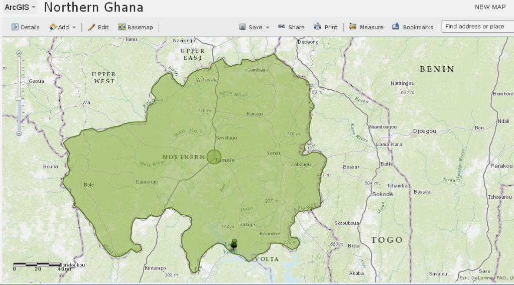
Appendix 2: The Road Network within Northern Ghana
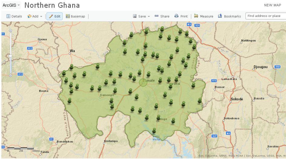
Appendix 3: The Major Soil Types in Northern Ghana
Appendix 4: The Major Rivers and Lakes in Northern Ghana
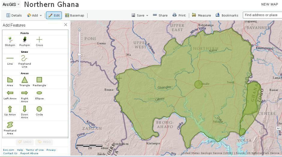
Appendix 5: The Elevation Map for Northern Ghana
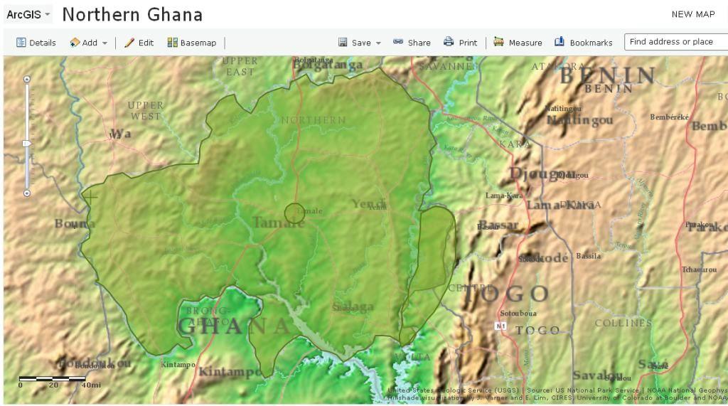
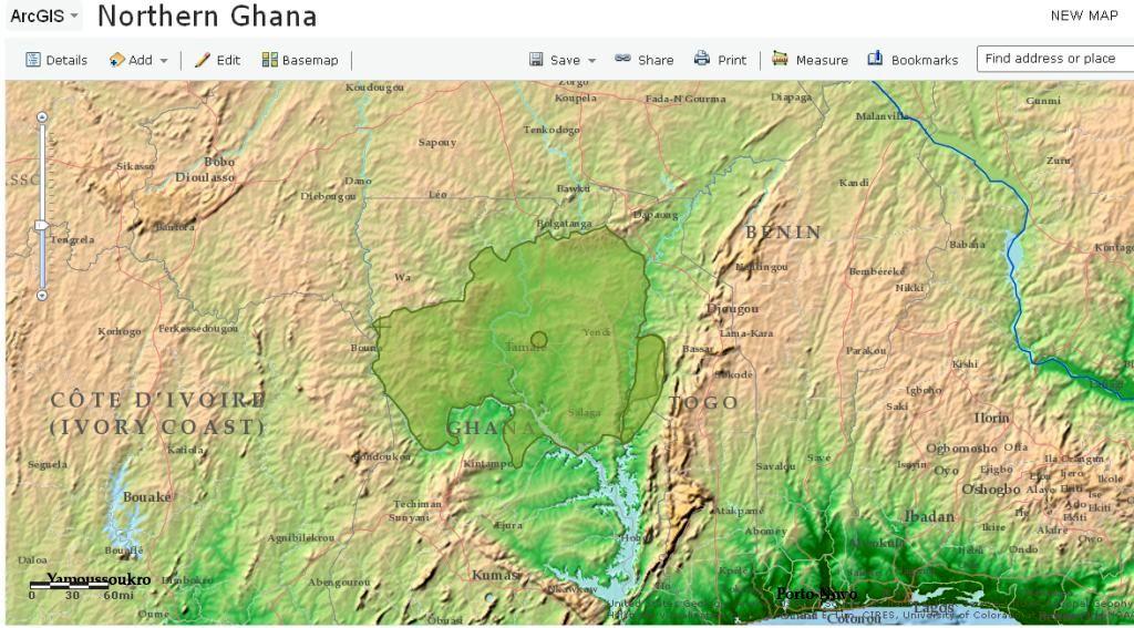
Appendix 6: The Geological Map for Northern Ghana
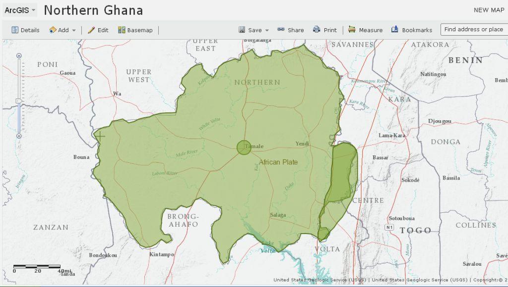
Appendix 7: Vegetation Cover for Northern Ghana
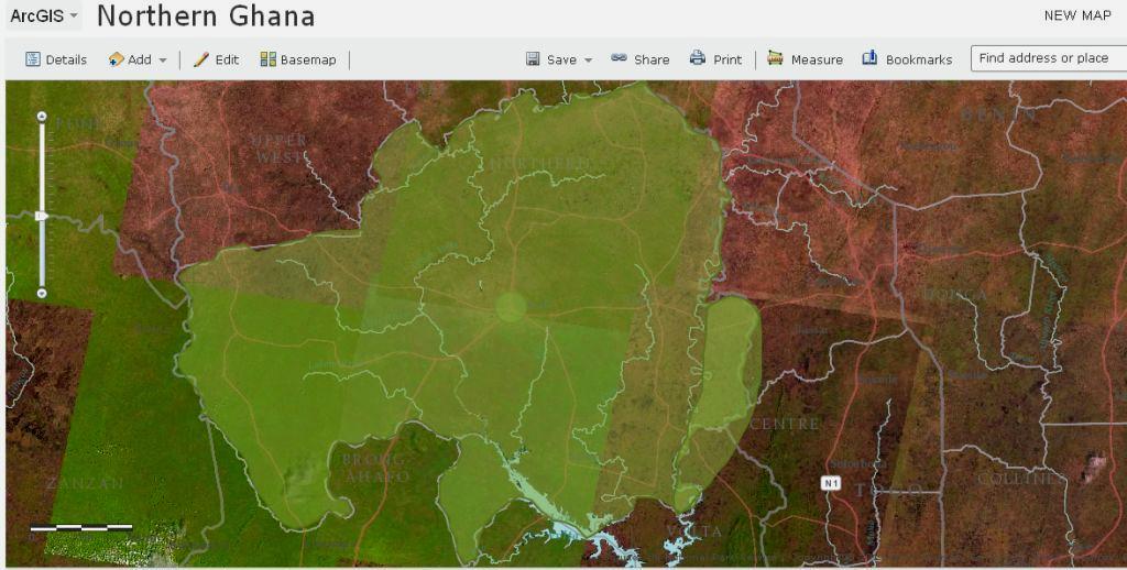
Reference List
Abagale, K F, Mensah, A & Osei, R A 2012, ‘Urban solid waste sorting in a growing city of Ghana’, International Journal of Environment and Sustainability, vol. 1, no. 4, pp. 18–25.
Abbreviated preliminary assessment for Genesee landfill. 2012. Web.
Abdul-Barik, A-H 2012, Location of the semi-obnoxious facility and the transportation of solid waste in the Northern Region of Ghana, Web.
Afzari, A, Samani, J M V & Rashid, M 2011, ‘Municipal landfill site selection for Isfahan city by use of fuzzy logic and analytic hierarchy process’, Itranian Journal of Environmental Health, vol. 8, no. 3, pp. 273–284.
Alazem, D 2012, GIS model on heavy metal supply to the Kvillebacken stream, Gothenburg. Web.
Al-Yaqout, A F, Koushki, P A, & Hamoda, M F 2002, ‘Public opinion and siting solid waste landfills in Kuwait’, Resources, Conservation and Recycling, no. 35. Web.
Anggraini, O D & Rahardyan, B n. d., Landfill site selection using GIS method in West Bandung Regency. Web.
ArcGIS spatial analyst: Advanced GIS spatial analyst using raster and vector data. 2001. Web.
ATEC Associated, Inc. 1992, Geotechnical and hydrogeologic investigation. Web.
Babalola, A & Busu, I 2011, ‘Selection of landfill sites for solid waste treatment in Damaturu town-using GIS techniques’, Journal of Environmental Protection, vol. 2, no. 1, pp. 1–10.
Ball, J 2005, Landfill site selection. Web.
Basnet, B R 2001, ‘Selecting suitable sites for animal waste application using a raster GIS’, Environmental Management vol. 28 no. 4, pp. 519–531.
Boyle, E 2004, ‘Congenital anomalies and proximity to landfill sites’, Irish Medical Journal, vol. 97, no. 1, pp. 16–18.
Bozzo, P 2010, A landfill causes protests in Ghana. Web.
El Agi, Z, Elhadari, R & Elashry, A 2010, ‘Integrating GIS and MCDM to deal with landfill site selection’, International Journal of Engineering & Technology, vol. 10, no. 6, pp. 33–40.
Eldrandaly, K 2003, ‘A COM-based spatial decision support system for industrial site selection’, Journal of Geographic Information and Decision Analysis, vol. 7, no. 2, pp. 72–92.
Environmental Protection Agency 2000, Landfill manuals. Web.
Ganesan, B 2010, Landfill sites location. Web.
Galgani, P 2012, ‘Compost, biogas and biochar in Northern Ghana’. Web.
GIS for public works n. d., Web.
Jayawickrama, N T & Weerasinghe, W P A n. d., GIS application in locating suitable sites for solid waste landfills. Web.
Information note: 017. Landfill sites as waste management option in Ghana 2012, Web.
KSDK 2013, May, 30, EPA report: Radioactive landfill material poses no health risk. Web.
Kumar, D, Khare, M & Alpat, R I 2002, Threat to the groundwater from the municipal landfill sites in Delhi, India. Web.
Landfill design and operation. 2006. Web.
Mahama, A 2011, Ghana second dirtiest in West Africa. Web.
Mensah, A & Larbi, E 2005, Solid waste disposal in Ghana. Web.
Mohammadzadeh, H 2010, Spatial Statistical Analysis of Groundwater using Geopack and ArcGIS,The 1st International Applied Geological Congress, Department of Geology, Islamic Azad University, Mashad Branch, Iran, pp. 26-28.
Mohammadzadeh, H, Daneshfar, B, Clark, I D, &Johnson, T n. d, Spatial statistical analysis of groundwater in Nepean and trail road landfill sites, Ottawa, Canada, by Geopack and ArcGIS. Web.
Munsell, D R 2013, Energy power plants: Estimating the solar potential of closed landfills in California. Web.
Nas, B, Key, T & Isacn, F 2010, ‘Selection of MSW landfill site for Konya, Turkey using GIS and multi-criteria evaluation’, Environmental Monitored Access, vol. 160, pp. 491–500.
Ormsby, T 2004, Getting to know ArcGIS Desktop: Basics of ArcView, ArcEditor and ArcInfo, ESRI, Inc., Redlands, CA.
Schroder, D 2012, GIDEC – advanced GIS training. Web.
Shaker, A & Yan, W Y n. d., Trail road landfill site monitoring using multi-temporal landsat satellite data. Web.
Siting of landfill in Ghana n. d. Web.
Tao, C V & Li, J 2007, Advances in mobile mapping technology: ISPRS series, Taylor & Francis, New York, NY.
Taylor, R & Allen, A n. d., Waste disposal and landfill: information needs, Web.
UNICEF 2011, UNICEF IWASH Project, Northern Region, Ghana: an adapted training manual for groundwater development. Web.
Waste policy guidance: WM13 and WM15 site selection criteria. 2013. Web.
(WEIJA) GA SOUTH: youth block landfill site over increased cholera cases. 2013. Web.