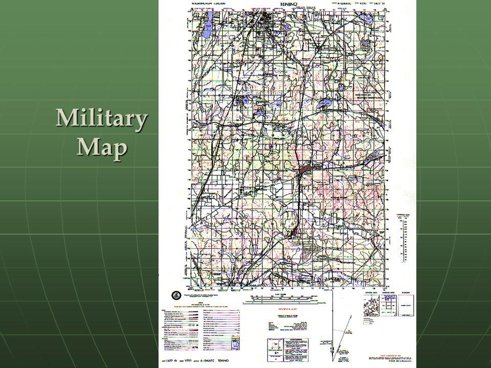
An in-depth topographic map shows a region’s artificial and natural structures. Contour lines outline relief features such as mountains and rivers to indicate their height. Ordinary military maps are usually to the scale of 1:50,000 with identifiable topographic symbols and colors in addition to specific marginal information. Military personnel utilizes topographic maps in the field to move from point to point through grid coordinates and correct identification of topographic symbols. Symbols in an army map should be easily understood and communicate landscape elements to military personnel, thus making vital contributions to navigation and operations.
Identifying features and understanding how to read a topographical map begins with an innate understanding of symbols. Their size and shape often denote the intended purpose. For instance, a blue snaking feature is a river, whereas a black square represents a house.
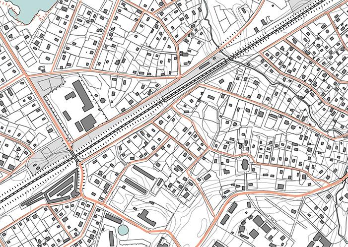
Moreover, colors are integral to communicating messages quickly and distinctively. Based on their coding, they make logical sense to the map reader; for instance, blue demarcates water, whereas green represents vegetation. These visual aids are linked to the physical appearance of these features in everyday life, making their identification easy. Furthermore, the size often corresponds to the scale and is enhanced to ensure the reader can distinguish all elements in a map. However, using the legend is a dependable technique for object identification since it contains a list of the basic symbols used in a map.
Topographic maps also contain marginal information on the legend at the top and bottom of the paper. At the top left, the cartographer includes the geographic location and scale of the map. The name appears at the top center, whereas the map edition, series, and sheet number are at the top right. Alternatively, the marginal information at the bottom begins with a repetition of the sheet number, name, and information on the agency that prepared the map. The bottom portion contains the scales, the contour interval, the declination diagram, the grid reference box, and the grid magnetic angle.
Topographic symbols use colors such as blue, brown, and blue to define various features within a military map. Cartographers use consistent colors to mark features on the ground across all topographic maps. Blue denotes drainage and water features such as rivers, swamps, and streams.
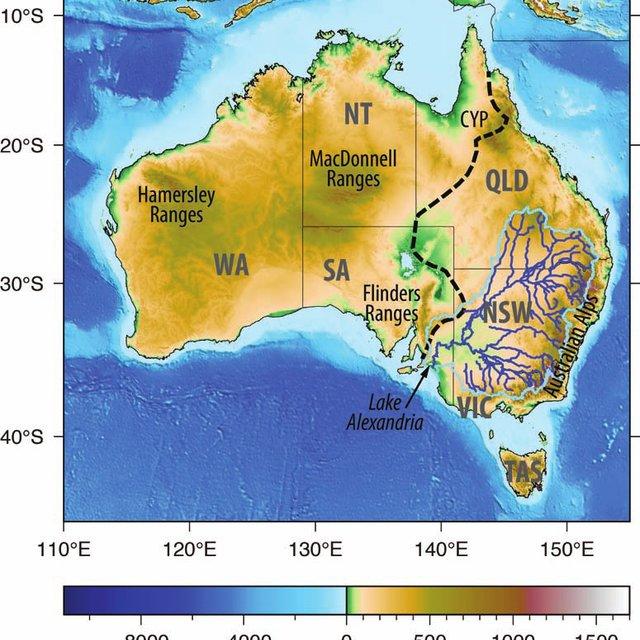
Relief features such as dunes, levees, and glaciers appear as brown contour lines. Additionally, some features utilize form lines and intermediate contour lines. Consistency produces a visually appealing map whose features are easily distinguishable.
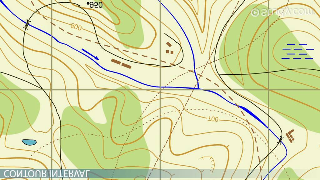
The vegetation, as seen above, such as trees and forests, is shaded in green. They may also include grass, orchards, and tundra in the region. Artificial features such as roads, boundaries, and railways are colored black or red to stand out on the map. The roads may be complicated or medium-surface, depending on the structure and purpose.
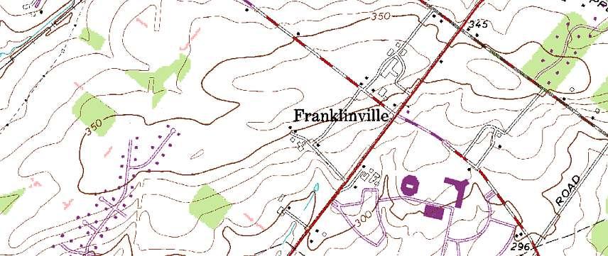
Lastly, buildings can be black, yellow, or pink, depending on the map and specification level. A military topographical map is highly detailed and contains relevant information about the landscape.
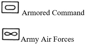
In addition to topographic features, military maps contain symbols explaining the military structure’s occupations. These symbols are encased in a rectangular outline and often utilize a black-and-white graphic format. An infinity loop and an ellipsis represent the Army Air Forces and the Armored Command.
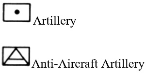
Similarly, whereas a dot marks the Artillery, the Anti-Aircraft Artillery has an encased capitalized A for ease of identification.
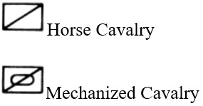
Whether horse or mechanized, Cavalry have a diagonal straight line through them. In the latter’s case, it is simply a negation of the Armored Command symbol.
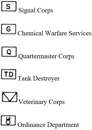
Some symbols are designed by including a relatable letter and are primarily pertinent to task specialization. For instance, the Engineer Unit has a capital E, whereas the Quartermaster Corps contains a Q.
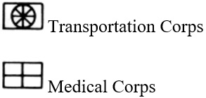
However, the Transportation Corps and Medical Corps are exceptions since they adopt a graphical format.
Other military symbols include the size of the military unit, weapons in use and unit designation. They all work together to ensure each soldier is accurately briefed on the duties they are supposed to carry out. Reading a map accurately is a part of basic training and is extremely essential to tactical planning.
In conclusion, topographic maps show the elevation and shape of landform elevations. Military topographic maps provide detailed and accurate information to soldiers, allowing them to navigate and execute their operations efficiently. Some distinguishing features include color, object shapes, and marginal information in the map legend. Color must always be logically sound; for instance, blue represents water, whereas green marks vegetation. These colors are relatable to objects on the ground. Furthermore, excellent topographic maps single out information such as map sheet names, series, and production agencies to enhance credibility among its readers. Topographic maps improve military operations through color, shape, and size to communicate a myriad of information quickly and efficiently.